MyTopo
Westfield East Illinois US Topo Map
Couldn't load pickup availability
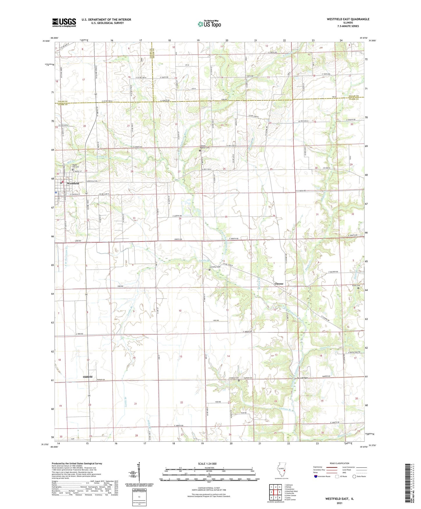
2024 topographic map quadrangle Westfield East in the state of Illinois. Scale: 1:24000. Based on the newly updated USGS 7.5' US Topo map series, this map is in the following counties: Clark, Edgar, Coles. The map contains contour data, water features, and other items you are used to seeing on USGS maps, but also has updated roads and other features. This is the next generation of topographic maps. Printed on high-quality waterproof paper with UV fade-resistant inks.
Quads adjacent to this one:
West: Westfield West
Northwest: Ashmore
North: Kansas
Northeast: Grandview
East: Clarksville
Southeast: Clark Center
South: Casey
Southwest: Union Center
This map covers the same area as the classic USGS quad with code o39087d8.
Contains the following named places: Baber Woods Nature Preserve, Bluegrass Creek, Briscoe School, Clark County Ambulance Service, Cleone, Connelly Cemetery, Conrad Baptist Cemetery, Doyles Creek, East Fork Creek, Ennis Cemetery, Johnson School, Lambs Branch, Lee School, Lindsay Branch, Lindsay School, Lindsey Cemetery, Maple Hill Cemetery, McNary Branch, Mill Creek, Mount Olive Church, Oilfield, Richwood Church, Richwood School, Scattering Grove, Slater Creek, Township of Parker, Township of Westfield, Twin Bridges, Village of Westfield, West Fork Creek, West Liberty School, Westfield, Westfield Fire Protection District, Westfield Police Department, Westfield Post Office