MyTopo
Westfield West Illinois US Topo Map
Couldn't load pickup availability
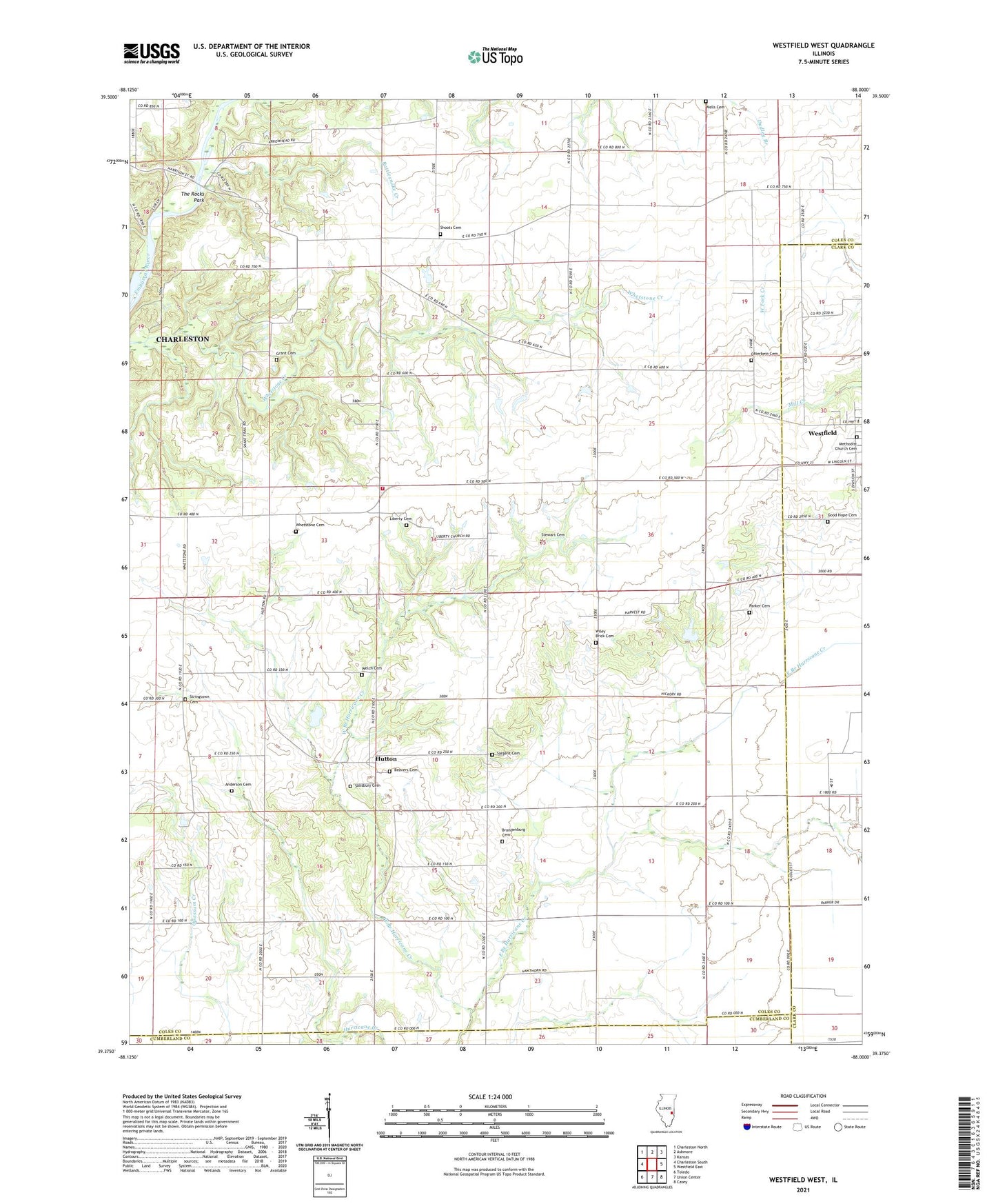
2024 topographic map quadrangle Westfield West in the state of Illinois. Scale: 1:24000. Based on the newly updated USGS 7.5' US Topo map series, this map is in the following counties: Coles, Clark, Cumberland. The map contains contour data, water features, and other items you are used to seeing on USGS maps, but also has updated roads and other features. This is the next generation of topographic maps. Printed on high-quality waterproof paper with UV fade-resistant inks.
Quads adjacent to this one:
West: Charleston South
Northwest: Charleston North
North: Ashmore
Northeast: Kansas
East: Westfield East
Southeast: Casey
South: Union Center
Southwest: Toledo
This map covers the same area as the classic USGS quad with code o39088d1.
Contains the following named places: Anderson Cemetery, Beavers Cemetery, Berkeley School, Bladenburg School, Brandenburg Cemetery, Center School, Connelly School, Davis School, East Branch Hurricane Creek, Goble School, Good Hope Cemetery, Grant Cemetery, Hutton, Hutton Fire Protection District, Hutton School, Johns School, Liberty Cemetery, Little Brick School, Methodist Church Cemetery, Olmstead School, Otterbein Cemetery, Parker Cemetery, Rattlesnake Creek, Rennels School, Salisbury Cemetery, Sargent Cemetery, Shoots Cemetery, Stewart Cemetery, Stringtown Cemetery, Stringtown School, The Rocks Park, Township of Hutton, Weaver Chapel, Welch Cemetery, West Branch Hurricane Creek, Wever Grove, Whetstone Cemetery, Wiley Brick Cemetery, Wiley School, ZIP Code: 62474