MyTopo
Bourbon Indiana US Topo Map
Couldn't load pickup availability
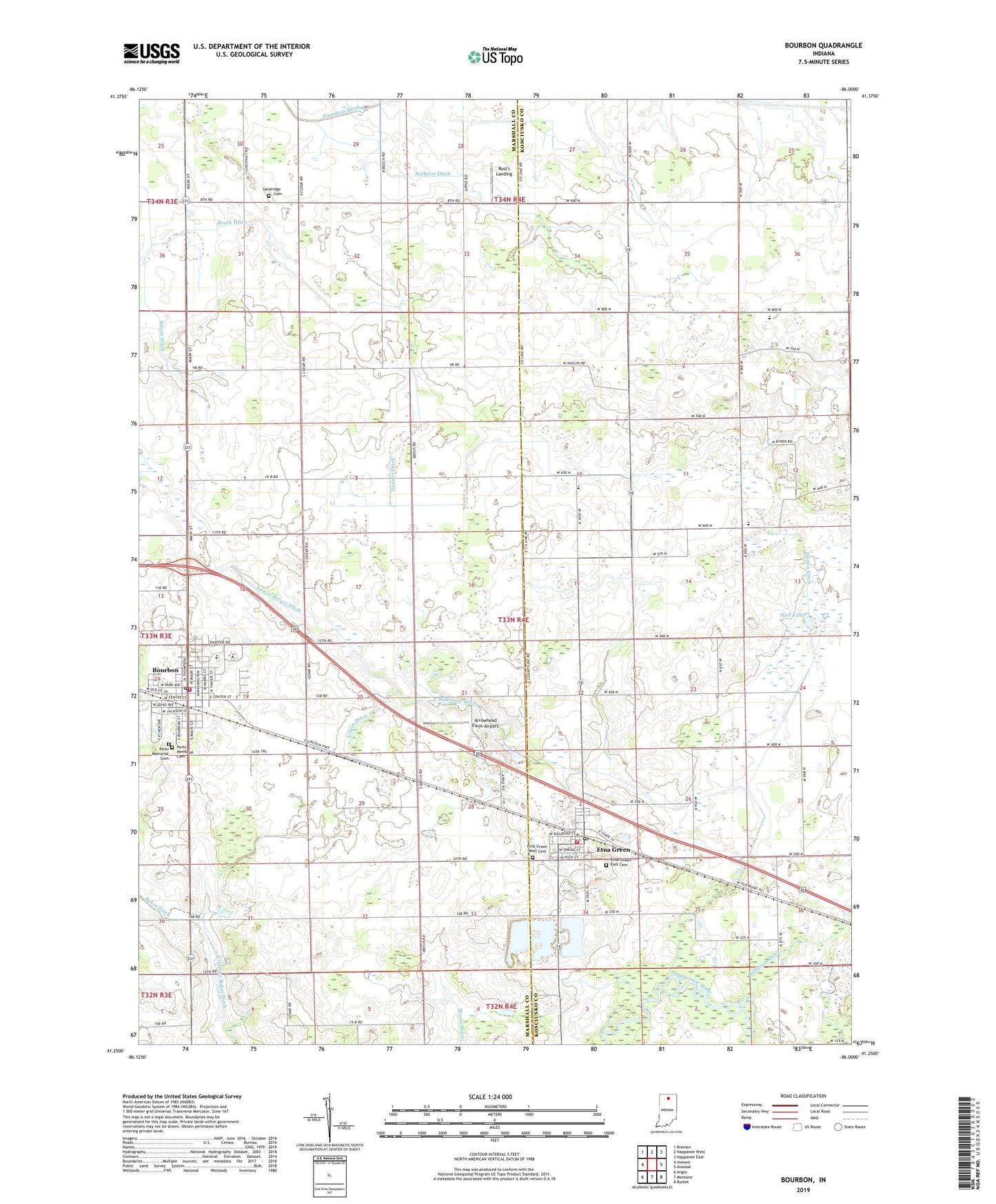
2022 topographic map quadrangle Bourbon in the state of Indiana. Scale: 1:24000. Based on the newly updated USGS 7.5' US Topo map series, this map is in the following counties: Kosciusko, Marshall. The map contains contour data, water features, and other items you are used to seeing on USGS maps, but also has updated roads and other features. This is the next generation of topographic maps. Printed on high-quality waterproof paper with UV fade-resistant inks.
Quads adjacent to this one:
West: Inwood
Northwest: Bremen
North: Nappanee West
Northeast: Nappanee East
East: Atwood
Southeast: Burket
South: Mentone
Southwest: Argos
This map covers the same area as the classic USGS quad with code o41086c1.
Contains the following named places: Arm Number Two Ditch, Arrowhead Farm Airport, Baker Ditch, Bourbon, Bourbon Emergency Medical Service, Bourbon Fire Department, Bourbon Police Department, Bourbon Post Office, Bourbon Public Library, Brock Ditch, Camp Creek Church, Danner Ditch, Erwin Ditch, Etna Green, Etna Green East Cemetery, Etna Green Post Office, Etna Green West Cemetery, Etna Township Fire Department, Fairview Church, Foster Chapel, Hanes Farms, J and M Gravel Pit, Jerusalem Church, Kinzie Ditch, Knepp Farms, Lemer-Berger Ditch, Lemlar Farms, Lemler Ditch, Martin Ditch, Miller Farms, Millwood Chapel, Mud Lake, Parks Memorial Cemetery, Ridenour Ditch, Robinson Ditch, Rust's Landing, Saint Pauls Church, Sandridge Cemetery, Sechrist Ditch, Town of Bourbon, Town of Etna Green, Township of Etna, ZIP Codes: 46504, 46524