MyTopo
Nappanee West Indiana US Topo Map
Couldn't load pickup availability
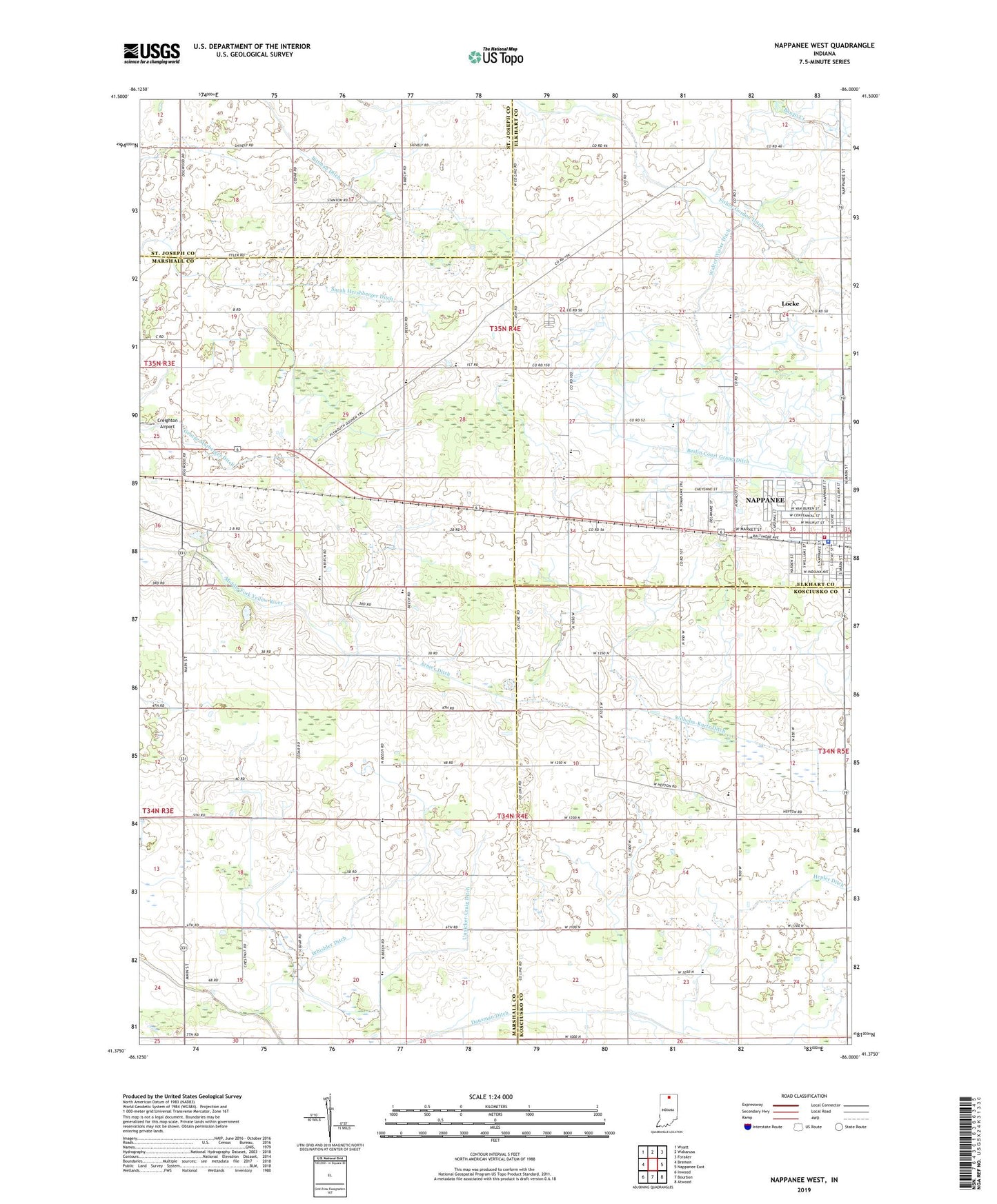
2022 topographic map quadrangle Nappanee West in the state of Indiana. Scale: 1:24000. Based on the newly updated USGS 7.5' US Topo map series, this map is in the following counties: Marshall, Elkhart, Kosciusko, St. Joseph. The map contains contour data, water features, and other items you are used to seeing on USGS maps, but also has updated roads and other features. This is the next generation of topographic maps. Printed on high-quality waterproof paper with UV fade-resistant inks.
Quads adjacent to this one:
West: Bremen
Northwest: Wyatt
North: Wakarusa
Northeast: Foraker
East: Nappanee East
Southeast: Atwood
South: Bourbon
Southwest: Inwood
This map covers the same area as the classic USGS quad with code o41086d1.
Contains the following named places: Armey Ditch, Borkholder Farm, Borkholder School, Ebenezer County Line Church, First Brethren Church, Fisher-Gordon Ditch, George Marberger Ditch, Hepler Ditch, Hepton Union Church, Heritage Trail Farm, Koontz Farm, Living Gospel Church, Locke, Maple Lawn Church, Nappanee, Nappanee Brethren in Christ Church, Nappanee Emergency Medical Services, Nappanee Fire Department Headquarters, Nappanee Police Department, Nappanee Public Library, North Main Street Mennonite Church, Oak Grove Church, Our Lady of Perpetual Help Church, Pippenger Farms, Pittman Ditch, Saint John's Lutheran Church, Sarber Farm, Shaum Dairy, Slabaugh Farms, South Union Chapel, Thomas Farms, Township of Locke, Township of Scott, Unsicker Farms, Unsicker-Craig Ditch, Walter Wisler Ditch, Weldy Amish School, Whishler Ditch, Zion Mennonite Church, ZIP Code: 46550