MyTopo
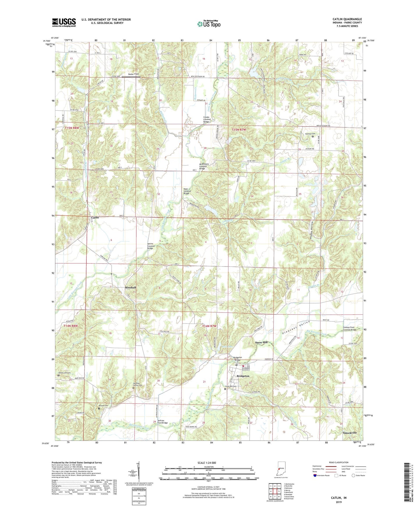
Catlin Indiana US Topo Map
Couldn't load pickup availability
2022 topographic map quadrangle Catlin in the state of Indiana. Scale: 1:24000. Based on the newly updated USGS 7.5' US Topo map series, this map is in the following counties: Parke. The map contains contour data, water features, and other items you are used to seeing on USGS maps, but also has updated roads and other features. This is the next generation of topographic maps. Printed on high-quality waterproof paper with UV fade-resistant inks.
Quads adjacent to this one:
West: Mecca
Northwest: Montezuma
North: Rockville
Northeast: Bellmore
East: Mansfield
Southeast: Brazil East
South: Brazil West
Southwest: Rosedale
This map covers the same area as the classic USGS quad with code o39087f2.
Contains the following named places: Adams Lee Cemetery, Aitken Lake Dam, Bridgeton, Bridgeton Bridge, Bridgeton Elementary and Junior High School, Bridgeton Fire Department, Bridgeton Post Office, Bridgeton Volunteer Fire Department, Brunot Cemetery, Butler Field, Case Lake, Catlin, Clear Run, Clear Run Cemetery, Conleys Ford Covered Bridge, Crooks Covered Bridge, Ferguson Branch, Ford Run, Happy Hollow, Hartman Family Cemetery, Hatfield Cemetery, Hopper Branch, Jeffries Ford Bridge, Jeffries Run, Lakeland, Lakeys Branch, Leatherwood Branch, Little Raccoon Structure Number 16, McAllisters Covered Bridge, Minshall, Molasses Creek, Mount Olivet Church, Neet Covered Bridge, Nevins Covered Bridge, New Discovery, New Discovery Church, Piattsville, Pleasant Valley, Pleasant Valley Church, Smockville, Snow Hill, Strange Branch, Sunderland Branch, Superior, Township of Adams, Township of Raccoon, Walton, Williams Creek, Zellors Pond, ZIP Code: 47836