MyTopo
Montezuma Indiana US Topo Map
Couldn't load pickup availability
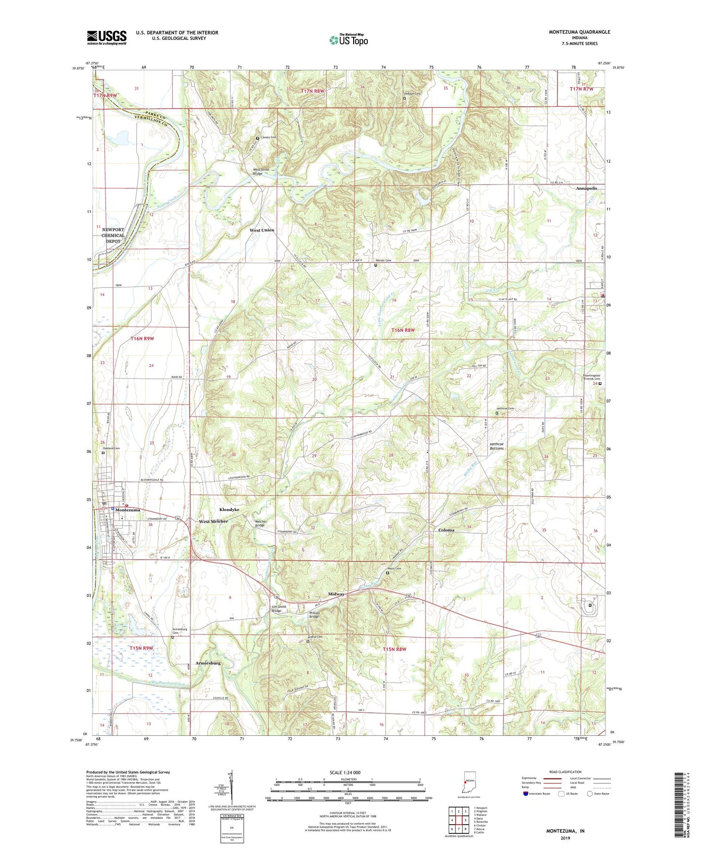
2022 topographic map quadrangle Montezuma in the state of Indiana. Scale: 1:24000. Based on the newly updated USGS 7.5' US Topo map series, this map is in the following counties: Parke, Vermillion. The map contains contour data, water features, and other items you are used to seeing on USGS maps, but also has updated roads and other features. This is the next generation of topographic maps. Printed on high-quality waterproof paper with UV fade-resistant inks.
Quads adjacent to this one:
West: Dana
Northwest: Newport
North: Kingman
Northeast: Wallace
East: Rockville
Southeast: Catlin
South: Mecca
Southwest: Clinton
This map covers the same area as the classic USGS quad with code o39087g3.
Contains the following named places: Annapolis, Annapolis Post Office, Arabia, Arabia Cemetery, Armiesburg, Armiesburg Cemetery, Bloomingdale Fire Department, Bloomingdale Friends Cemetery, Bloomingdale Post Office, Camp Weeapahko, Cat Creek, Causey Cemetery, Coke Oven Hollow, Coloma, DeBaun Cemetery, Friends Church, Hethcoe Bottoms, Hethcoe Cemetery, Klondyke, Leatherwood, Leatherwood Creek, Linebarger Chapel, Little Leatherwood Creek, Melcher, Melcher Bridge, Midway, Montezuma, Montezuma Elementary School, Montezuma Junior High and Senior High School, Montezuma Police Department, Montezuma Post Office, Montezuma Reserve Township Volunteer Fire Department, Oakland Cemetery, Phillips Bridge, Pottertown, Rockville Air Force Station, Rockville Correctional Facility, Rockville Fire Department, Rockville Training Center, Rocky Run, Rush Creek, Sim Smith Bridge, Stumptown, Sugar Creek, Town of Bloomingdale, Town of Montezuma, Township of Penn, Township of Reserve, Warner Cemetery, Watts Cemetery, West Melcher, West Union, West Union Bridge, ZIP Code: 47862