MyTopo
Clymers Indiana US Topo Map
Couldn't load pickup availability
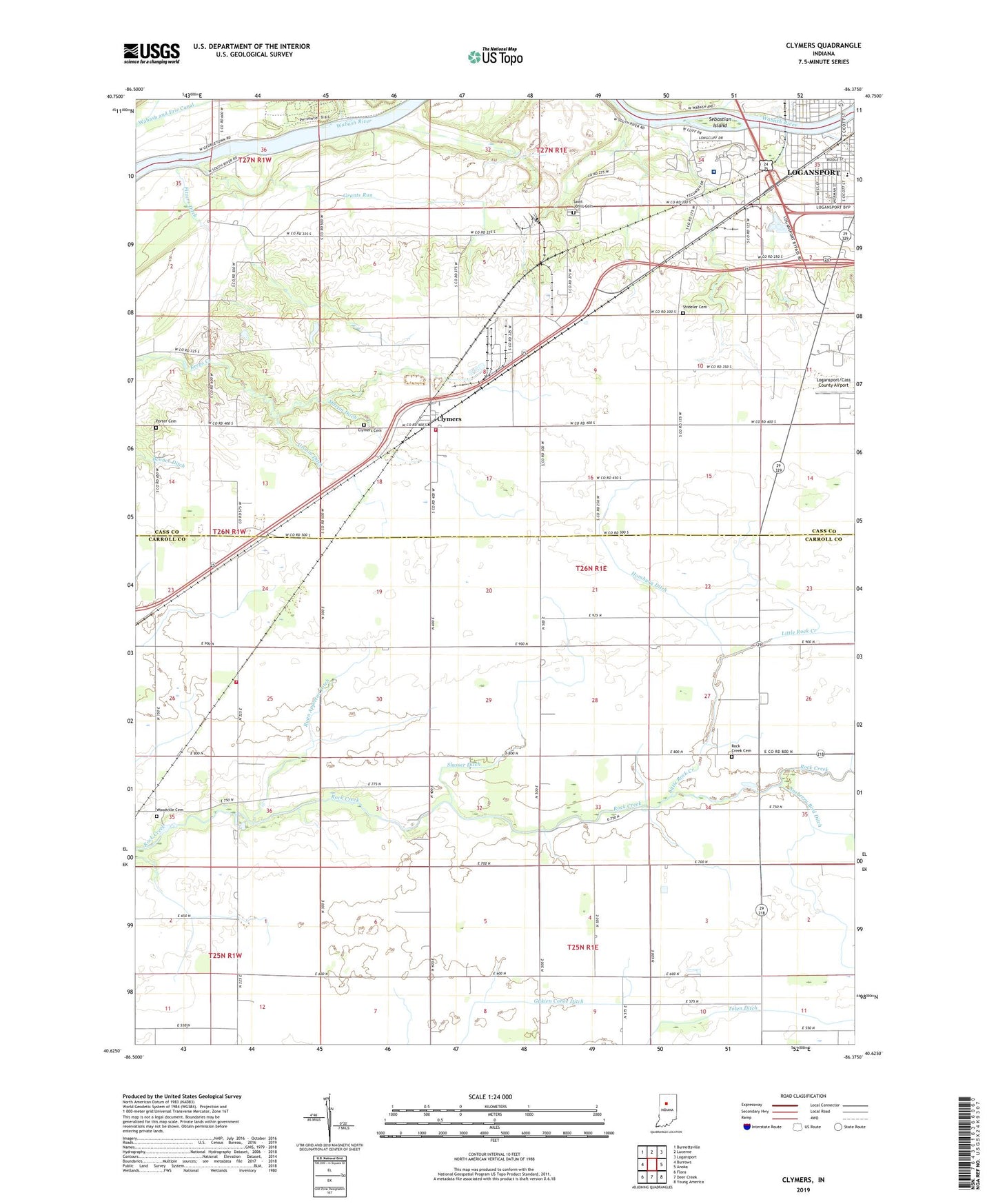
2022 topographic map quadrangle Clymers in the state of Indiana. Scale: 1:24000. Based on the newly updated USGS 7.5' US Topo map series, this map is in the following counties: Carroll, Cass. The map contains contour data, water features, and other items you are used to seeing on USGS maps, but also has updated roads and other features. This is the next generation of topographic maps. Printed on high-quality waterproof paper with UV fade-resistant inks.
Quads adjacent to this one:
West: Burrows
Northwest: Burnettsville
North: Lucerne
Northeast: Logansport
East: Anoka
Southeast: Young America
South: Deer Creek
Southwest: Flora
This map covers the same area as the classic USGS quad with code o40086f4.
Contains the following named places: Climbers Township Volunteer Fire Department, Clymers, Clymers Cemetery, Clymers Fire Department, Cronin Ditch, Fairview Park School, Fitzers Ditch, Goose Creek, Grants Run, Gukien Cohee Ditch, Homburg Ditch, Joyce Airport, Little Rock Creek, Logansport Quarry, Logansport State Hospital, Logansport/Cass County Airport, Martin Ditch, Porter Cemetery, Rock Creek Cemetery, Ryan Appleton Ditch, Saint Johns Cemetery, Saint Pisgah Church, Sebastian Island, Shideler Cemetery, Slusser Ditch, Township of Clinton, Township of Washington, Washington School, Widow Creek, Woodville Cemetery, ZIP Code: 46917