MyTopo
Young America Indiana US Topo Map
Couldn't load pickup availability
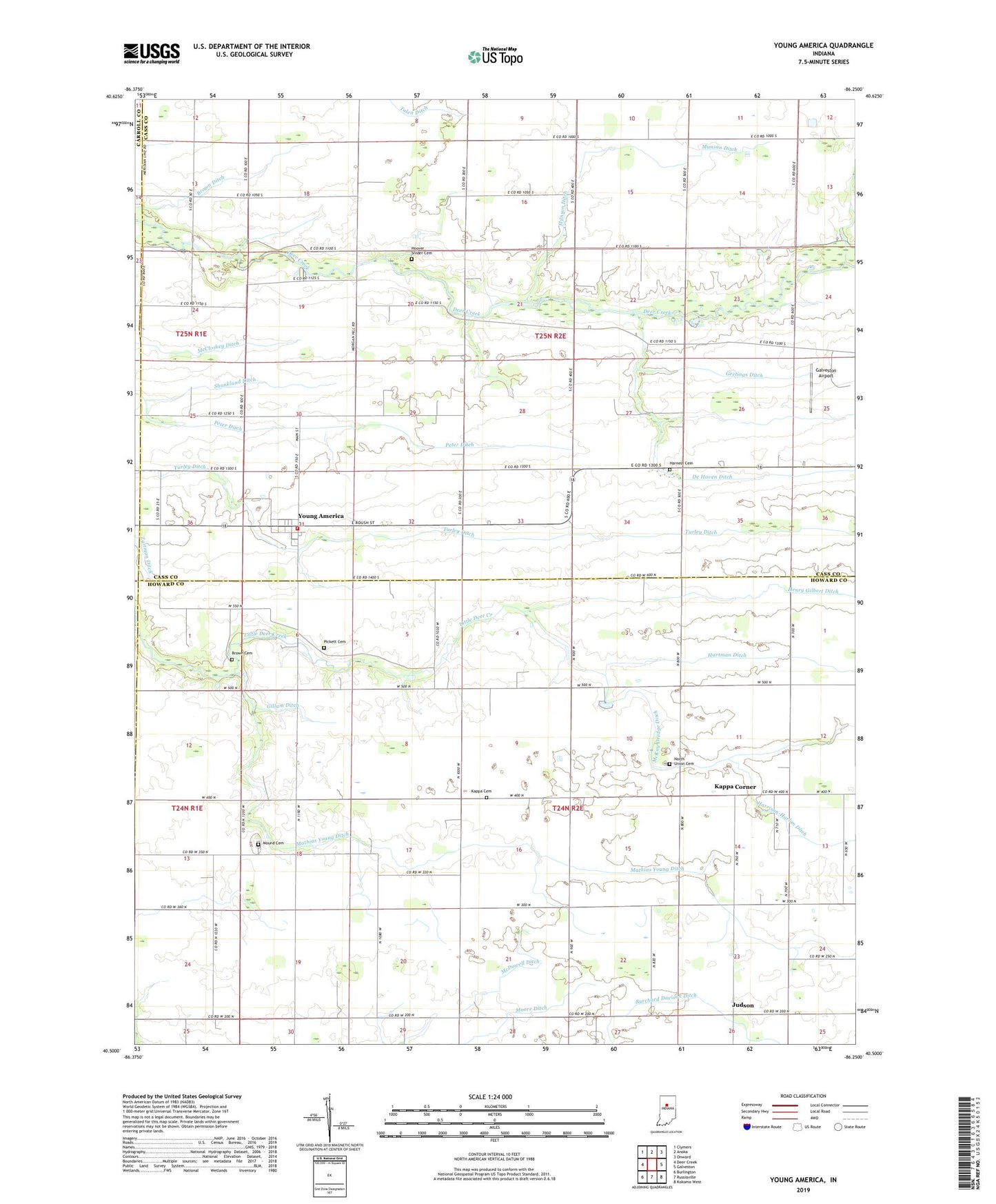
2022 topographic map quadrangle Young America in the state of Indiana. Scale: 1:24000. Based on the newly updated USGS 7.5' US Topo map series, this map is in the following counties: Howard, Cass, Carroll. The map contains contour data, water features, and other items you are used to seeing on USGS maps, but also has updated roads and other features. This is the next generation of topographic maps. Printed on high-quality waterproof paper with UV fade-resistant inks.
Quads adjacent to this one:
West: Deer Creek
Northwest: Clymers
North: Anoka
Northeast: Onward
East: Galveston
Southeast: Kokomo West
South: Russiaville
Southwest: Burlington
This map covers the same area as the classic USGS quad with code o40086e3.
Contains the following named places: Bethel Church, Brown Cemetery, Brown Ditch, Center Church, De Haven Ditch, Ervin Elementary School, Galveston Airport, Geetings Ditch, Gillam Ditch, Harness Cemetery, Harness Ditch, Hartman Ditch, Henry Gilbert Ditch, Hoover Snider Cemetery, Hyman Ditch, Judson, Kappa Cemetery, Kappa Corner, Mathias Young Ditch, McDowell Ditch, Moore Ditch, Mound Cemetery, Munson Ditch, North Union Cemetery, Peter Ditch, Pickett Cemetery, Poplar Grove, Poplar Grove Church, Shankland Ditch, Township of Deer Creek, Township of Ervin, Turley Ditch, Upper Deer Creek Church, Young America, Young America Volunteer Fire Department, Zion Church, ZIP Codes: 46932, 46998