MyTopo
Deer Creek Indiana US Topo Map
Couldn't load pickup availability
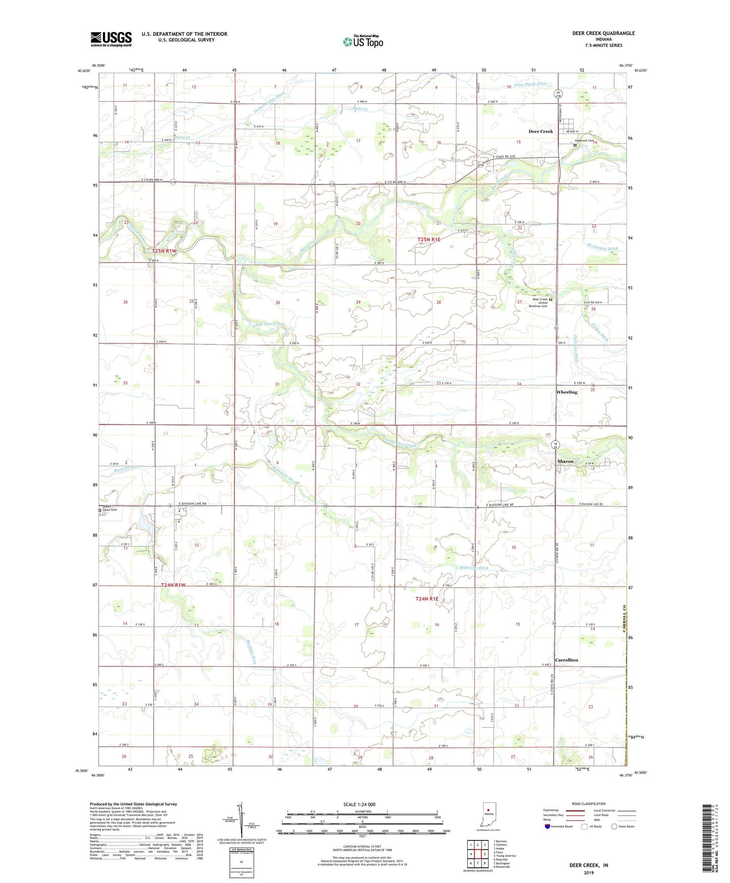
2022 topographic map quadrangle Deer Creek in the state of Indiana. Scale: 1:24000. Based on the newly updated USGS 7.5' US Topo map series, this map is in the following counties: Carroll, Howard. The map contains contour data, water features, and other items you are used to seeing on USGS maps, but also has updated roads and other features. This is the next generation of topographic maps. Printed on high-quality waterproof paper with UV fade-resistant inks.
Quads adjacent to this one:
West: Flora
Northwest: Burrows
North: Clymers
Northeast: Anoka
East: Young America
Southeast: Russiaville
South: Burlington
Southwest: Rossville
This map covers the same area as the classic USGS quad with code o40086e4.
Contains the following named places: Bachelor Run Church, Carroll County Emergency Medical Services, Carroll Junior-Senior High School, Carrollton, Deer Creek, Deer Creek Census Designated Place, Deer Creek Conservation Club, Deer Creek United Brethren Cemetery, Hopewell Cemetery, Little Deer Creek, Maple Lawn Cemetery, McCloskey Ditch, Paint Creek Church, Price Plank Ditch, Ridenour Ditch, Sharon, Township of Carrollton, Wheeling, Zartman Ditch, ZIP Code: 46929