MyTopo
Everton Indiana US Topo Map
Couldn't load pickup availability
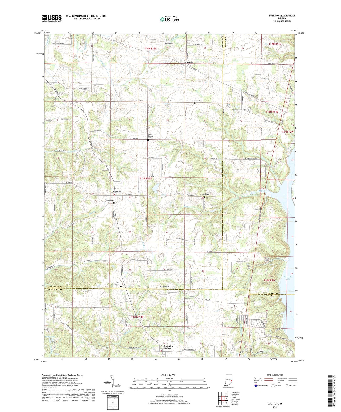
2022 topographic map quadrangle Everton in the state of Indiana. Scale: 1:24000. Based on the newly updated USGS 7.5' US Topo map series, this map is in the following counties: Fayette, Union, Franklin. The map contains contour data, water features, and other items you are used to seeing on USGS maps, but also has updated roads and other features. This is the next generation of topographic maps. Printed on high-quality waterproof paper with UV fade-resistant inks.
Quads adjacent to this one:
West: Alpine
Northwest: Connersville
North: Brownsville
Northeast: Liberty
East: New Fairfield
Southeast: Whitcomb
South: Brookville
Southwest: Metamora
This map covers the same area as the classic USGS quad with code o39085e1.
Contains the following named places: Alquina, Alquina Elementary School, Blooming Grove, Blooming Grove Volunteer Fire Department, Burke Cemetery, Duck Creek Stone Chapel, Ellys Creek, Everton, Everton Cemetery, Everton Volunteer Fire Department, Fishers Creek, Hanna Creek, Hanson Cemetery, Little Children Home Church, Mount Garrison Cemetery, O Waters Cemetery, Old Parrott Cemetery, Pinhook, Poplar Ridge Cemetery, Quakertown, Shady Lake, Township of Jackson, Township of Jennings