MyTopo
Brookville Indiana US Topo Map
Couldn't load pickup availability
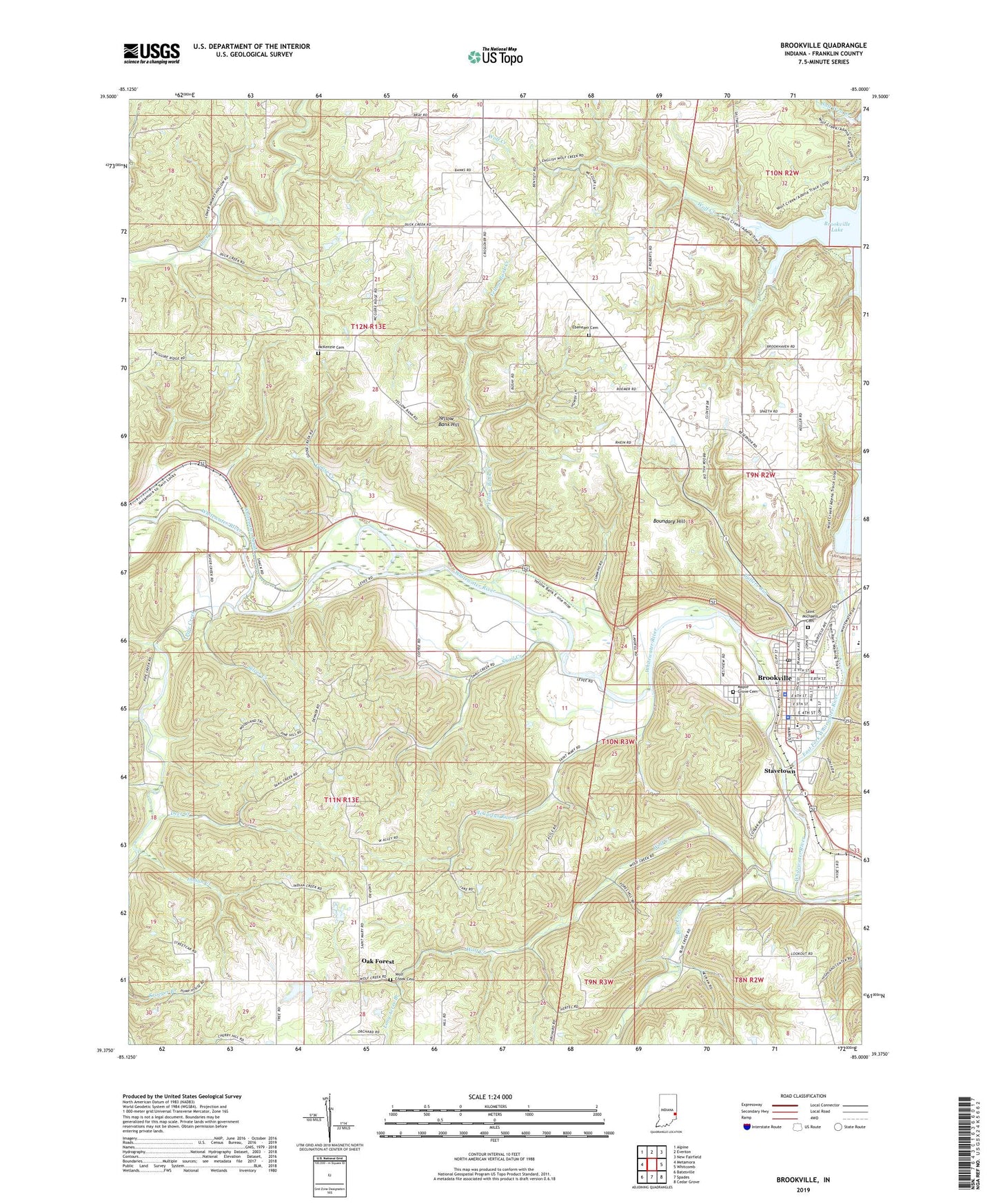
2022 topographic map quadrangle Brookville in the state of Indiana. Scale: 1:24000. Based on the newly updated USGS 7.5' US Topo map series, this map is in the following counties: Franklin. The map contains contour data, water features, and other items you are used to seeing on USGS maps, but also has updated roads and other features. This is the next generation of topographic maps. Printed on high-quality waterproof paper with UV fade-resistant inks.
Quads adjacent to this one:
West: Metamora
Northwest: Alpine
North: Everton
Northeast: New Fairfield
East: Whitcomb
Southeast: Cedar Grove
South: Spades
Southwest: Batesville
This map covers the same area as the classic USGS quad with code o39085d1.
Contains the following named places: Blue Creek, Boundary Hill, Brookville, Brookville Elementary School, Brookville Police Department, Brookville Post Office, Brookville Volunteer Fire Department, Butlers Run, Collett School, Deer Creek, Duck Creek, Duck Creek School, East Fork Whitewater River, Ebenezer Cemetery, Elm Grove Church, Elm Grove School, Flood Victims Memorial, Franklin County, Franklin County Emergency Medical Services Station 2, Franklin County Sheriff's Office, Gates Creek, Goose Creek, Indian Creek, Laurence Branch, Long Acres Branch, Maple Grove Cemetery, McCartys Run, McKenzie Cemetery, Millville, Oak Forest, Oak Forest Church, Philadephia Church, Pipe Creek, Plum Grove Church, Plum Grove School, Saint Michael School, Saint Michaels Cemetery, Saint Philomenas Church, Salt Well Creek, Silver Creek, Snail Creek, Stavetown, Town of Brookville, Township of Blooming Grove, Township of Brookville, Trace Branch, Tracy School, Whitewater Canal, Whitewater Canal Memorial, Whitewater Canal Memorial Lock, Wolf Creek, Wolf Creek Cemetery, Yellow Bank, Yellow Bank Creek, Yellow Bank Hill