MyTopo
Grammer Indiana US Topo Map
Couldn't load pickup availability
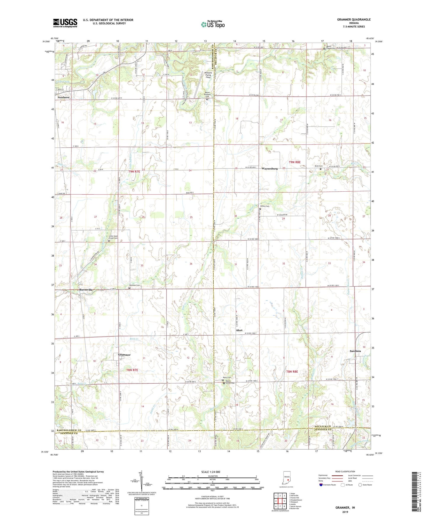
2022 topographic map quadrangle Grammer in the state of Indiana. Scale: 1:24000. Based on the newly updated USGS 7.5' US Topo map series, this map is in the following counties: Decatur, Bartholomew, Jennings. The map contains contour data, water features, and other items you are used to seeing on USGS maps, but also has updated roads and other features. This is the next generation of topographic maps. Printed on high-quality waterproof paper with UV fade-resistant inks.
Quads adjacent to this one:
West: Elizabethtown
Northwest: Hope
North: Hartsville
Northeast: Forest Hill
East: Westport
Southeast: Butlerville
South: North Vernon
Southwest: Azalia
This map covers the same area as the classic USGS quad with code o39085b6.
Contains the following named places: Alert, Asbury Cemetery, Bear Creek Church, Burnsville, Grammer, Little Sand Creek Cemetery, Middle Fork Fall Fork, Mount Olivet Cemetery, Mount Pisgah Cemetery, Mount Pleasant Cemetery, Parkison Cemetery, Sardinia, Shirk Cemetery, Township of Clifty, Township of Jackson, Township of Rock Creek, Waynesburg, Williams Flying Field, Wynn Cemetery, ZIP Code: 47244