MyTopo
Elizabethtown Indiana US Topo Map
Couldn't load pickup availability
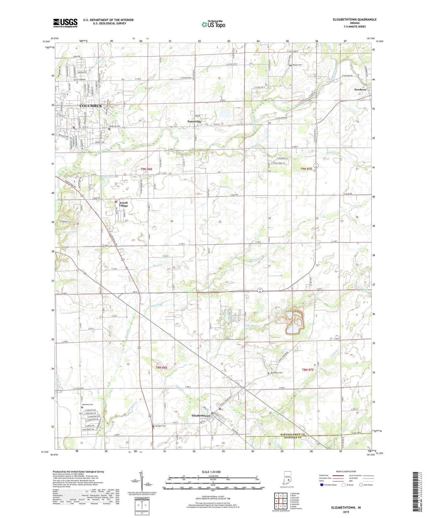
2022 topographic map quadrangle Elizabethtown in the state of Indiana. Scale: 1:24000. Based on the newly updated USGS 7.5' US Topo map series, this map is in the following counties: Bartholomew, Jennings. The map contains contour data, water features, and other items you are used to seeing on USGS maps, but also has updated roads and other features. This is the next generation of topographic maps. Printed on high-quality waterproof paper with UV fade-resistant inks.
Quads adjacent to this one:
West: Columbus
Northwest: Edinburgh
North: Hope
Northeast: Hartsville
East: Grammer
Southeast: North Vernon
South: Azalia
Southwest: Jonesville
This map covers the same area as the classic USGS quad with code o39085b7.
Contains the following named places: Brush Creek, Clay Township Fire Department, Clifty Creek Elementary School, Columbus Fire Department Station 4, Cooks Creek, Donaldson Cemetery, Duck Creek, Elizabethtown, Elizabethtown Post Office, Elizabethtown Volunteer Fire Department, Enon Church, Fishers Fork, Friendship Church, Harmony Cemetery, Jewell Village, Meshberger Quarry, Newbern, Otter Creek, Petersville, Saint Pauls Church, Sand Hill Cemetery, Sharon Cemetery, Shiloh Church, Sloan Branch, Springer Cemetery, Suhre Lake, Suhre Lake Dam, Town of Elizabethtown, Township of Clay, Trinity Church, Wesley Chapel, ZIP Code: 47203