MyTopo
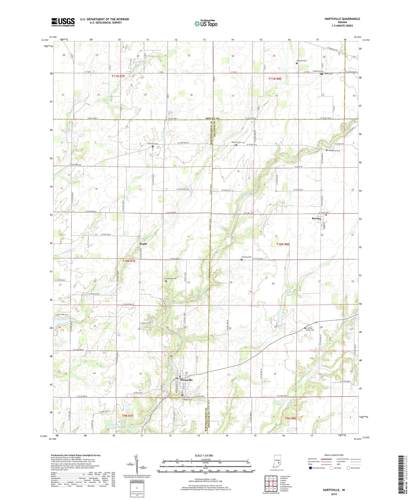
Hartsville Indiana US Topo Map
Couldn't load pickup availability
2022 topographic map quadrangle Hartsville in the state of Indiana. Scale: 1:24000. Based on the newly updated USGS 7.5' US Topo map series, this map is in the following counties: Decatur, Bartholomew, Shelby. The map contains contour data, water features, and other items you are used to seeing on USGS maps, but also has updated roads and other features. This is the next generation of topographic maps. Printed on high-quality waterproof paper with UV fade-resistant inks.
Quads adjacent to this one:
West: Hope
Northwest: Lewis Creek
North: Waldron
Northeast: Adams
East: Forest Hill
Southeast: Westport
South: Grammer
Southwest: Elizabethtown
This map covers the same area as the classic USGS quad with code o39085c6.
Contains the following named places: Bethel Church, Burney, Burney - Clay Township Volunteer Fire Department, Camp Clifty, Center Grove Cemetery, Copeland Cemetery, Fall Fork, Fletcher Cemetery, Galbraith Cemetery, Hartsville, Hartsville College Cemetery, Hartsville Post Office, Hartsville Volunteer Fire Department, Haw Creek Church, Jones Cemetery, Middle Fork Lake, Middle Fork Lake Dam, Mitchell Cemetery, Nauvoo Cemetery, Pleasant Grove Church, Pumphrey Cemetery, Rugby, Schultz Lake, Schultz Lake Dam, Swinney Cemetery, Town of Hartsville, Township of Haw Creek, Winterrow Post Office