MyTopo
Grass Creek Indiana US Topo Map
Couldn't load pickup availability
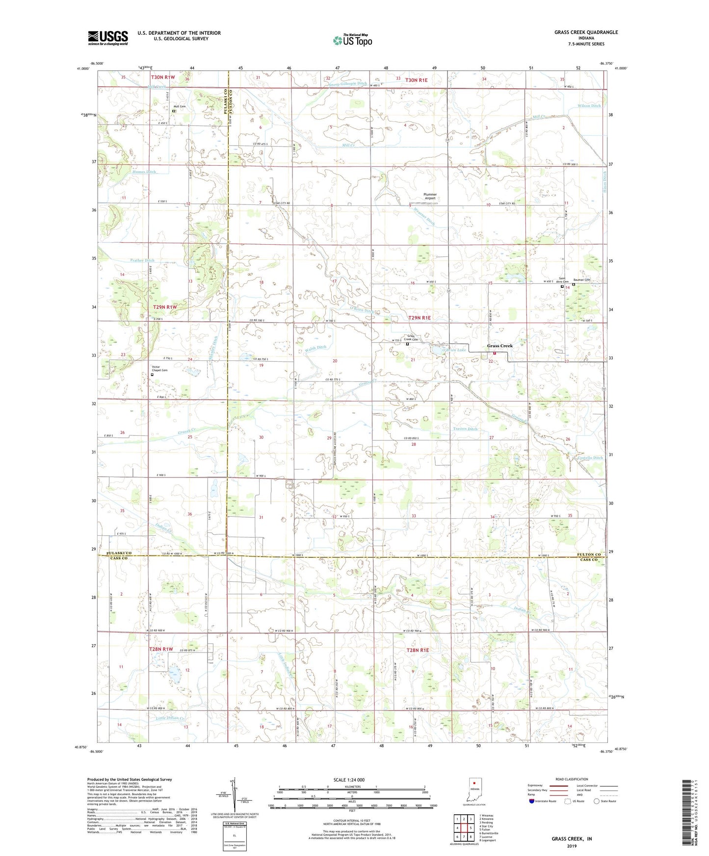
2022 topographic map quadrangle Grass Creek in the state of Indiana. Scale: 1:24000. Based on the newly updated USGS 7.5' US Topo map series, this map is in the following counties: Fulton, Cass, Pulaski. The map contains contour data, water features, and other items you are used to seeing on USGS maps, but also has updated roads and other features. This is the next generation of topographic maps. Printed on high-quality waterproof paper with UV fade-resistant inks.
Quads adjacent to this one:
West: Star City
Northwest: Winamac
North: Kewanna
Northeast: Pershing
East: Fulton
Southeast: Logansport
South: Lucerne
Southwest: Burnettsville
This map covers the same area as the classic USGS quad with code o40086h4.
Contains the following named places: Bauman Cemetery, Grass Creek, Grass Creek Cemetery, Hines Ditch, Humes Ditch, Indian Creek Church, Mull Cemetery, O'Brien Ditch, O'Brien Lake, Old Indian Creek Cemetery, Plummer Airport, Saint Anns Cemetery, Shanley Ditch, Township of Wayne, Travers Ditch, Victor Chapel Cemetery, Walsh Ditch, Wayne Township Volunteer Fire Department, Weasner Ditch, West Union Church, Wilson Ditch, ZIP Code: 46939