MyTopo
Winamac Indiana US Topo Map
Couldn't load pickup availability
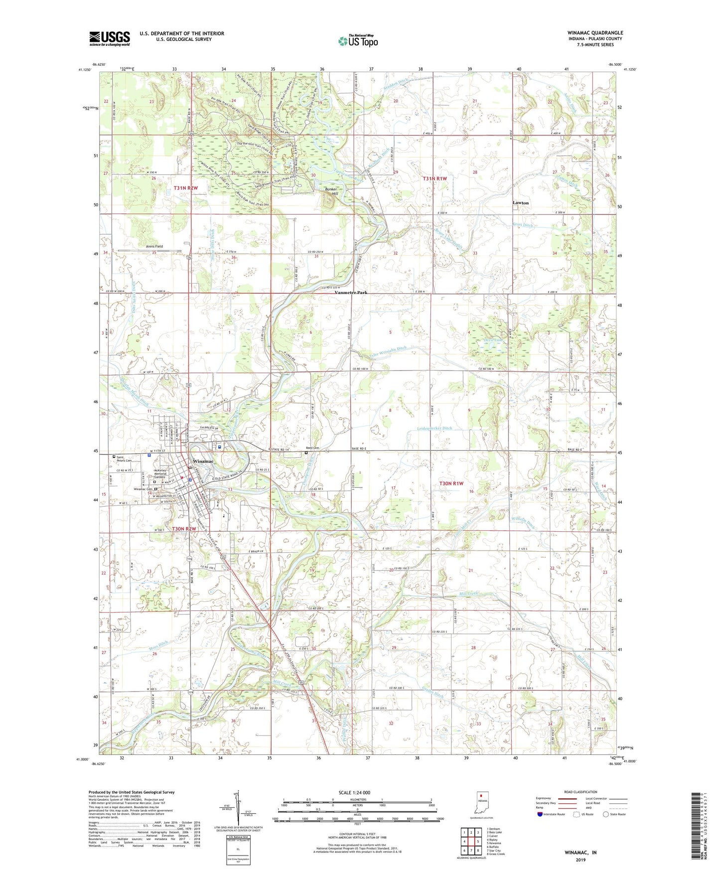
2022 topographic map quadrangle Winamac in the state of Indiana. Scale: 1:24000. Based on the newly updated USGS 7.5' US Topo map series, this map is in the following counties: Pulaski. The map contains contour data, water features, and other items you are used to seeing on USGS maps, but also has updated roads and other features. This is the next generation of topographic maps. Printed on high-quality waterproof paper with UV fade-resistant inks.
Quads adjacent to this one:
West: Ripley
Northwest: Denham
North: Bass Lake
Northeast: Culver
East: Kewanna
Southeast: Grass Creek
South: Star City
Southwest: Buffalo
This map covers the same area as the classic USGS quad with code o41086a5.
Contains the following named places: Anstis Ditch, Arens Field, Beason Park, Breckenridge Ditch, Bruce Lake Outlet, Bunker Hill, Camp Paxton, Devil Lake, Eastern Pulaski Elementary School, Fairview School, Graffis Ditch, Haschel Ditch, James Ditch, Kessi Ditch, Lawton, Leidendecker Ditch, Little Mill Creek, McKinley Memorial Gardens, Mill Creek, Miller Ditch, Pulaski County Emergency Medical Services, Pulaski County Sheriff's Office, Pulaski Memorial Hospital, Reed Cemetery, Reinhold Ditch, River Bank Church, Saint Peters Cemetery, Stone Dilts Ditch, Thompson Ditch, Town of Winamac, Township of Harrison, Tyler Weisjahn Ditch, Vanmeter Park, Wilhelm Ditch, Winamac, Winamac Cemetery, Winamac Community High School, Winamac Community Junior High School, Winamac Police Department, Winamac Post Office, Winamac State Fish and Wildlife Area, Winamac Volunteer Fire Department


