MyTopo
Pershing Indiana US Topo Map
Couldn't load pickup availability
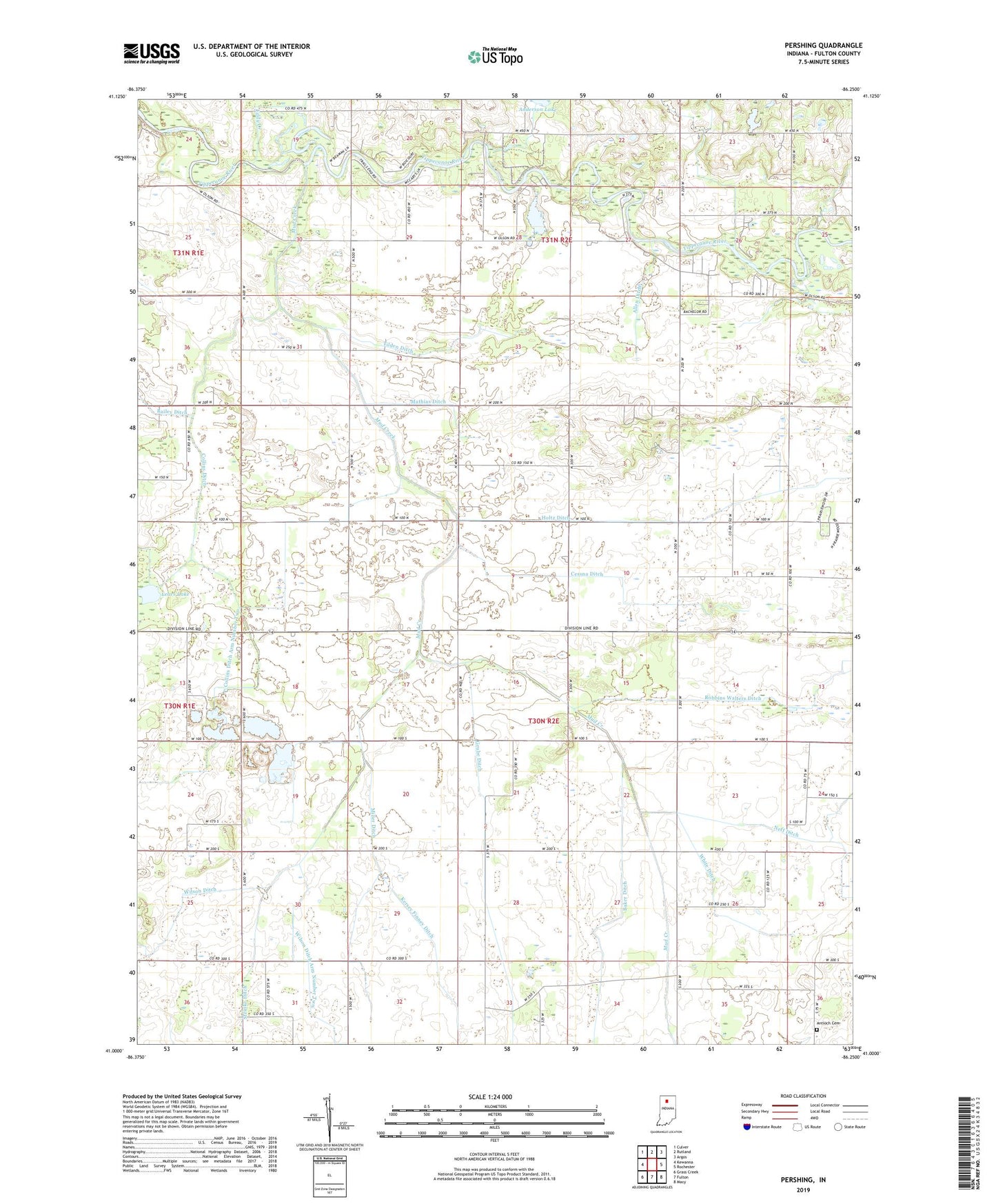
2022 topographic map quadrangle Pershing in the state of Indiana. Scale: 1:24000. Based on the newly updated USGS 7.5' US Topo map series, this map is in the following counties: Fulton. The map contains contour data, water features, and other items you are used to seeing on USGS maps, but also has updated roads and other features. This is the next generation of topographic maps. Printed on high-quality waterproof paper with UV fade-resistant inks.
Quads adjacent to this one:
West: Kewanna
Northwest: Culver
North: Rutland
Northeast: Argos
East: Rochester
Southeast: Macy
South: Fulton
Southwest: Grass Creek
This map covers the same area as the classic USGS quad with code o41086a3.
Contains the following named places: Allen Ditch, Antioch Cemetery, Baker Ditch, Burton Church, Cessna Ditch, Collins Ditch, Collins Ditch Arm Number Four, Collins Ditch Arm Number Three, Collins Ditch Arm Number Two, Eddy Creek, Fulton County, Grube Ditch, Holtz Ditch, Hudkins Ditch, Kersey Finney Ditch, Lears Lake, Mathias Ditch, Miller Ditch, Mud Creek, Pershing, Prairie Grove Church, Robbins Walters Ditch, Shakey Lake, Steinke Ditch, Tilden Ditch, White Ditch, Wilson Ditch, Wilson Ditch Arm Number Two, WROI-FM (Rochester), ZIP Code: 46975