MyTopo
LaPorte West Indiana US Topo Map
Couldn't load pickup availability
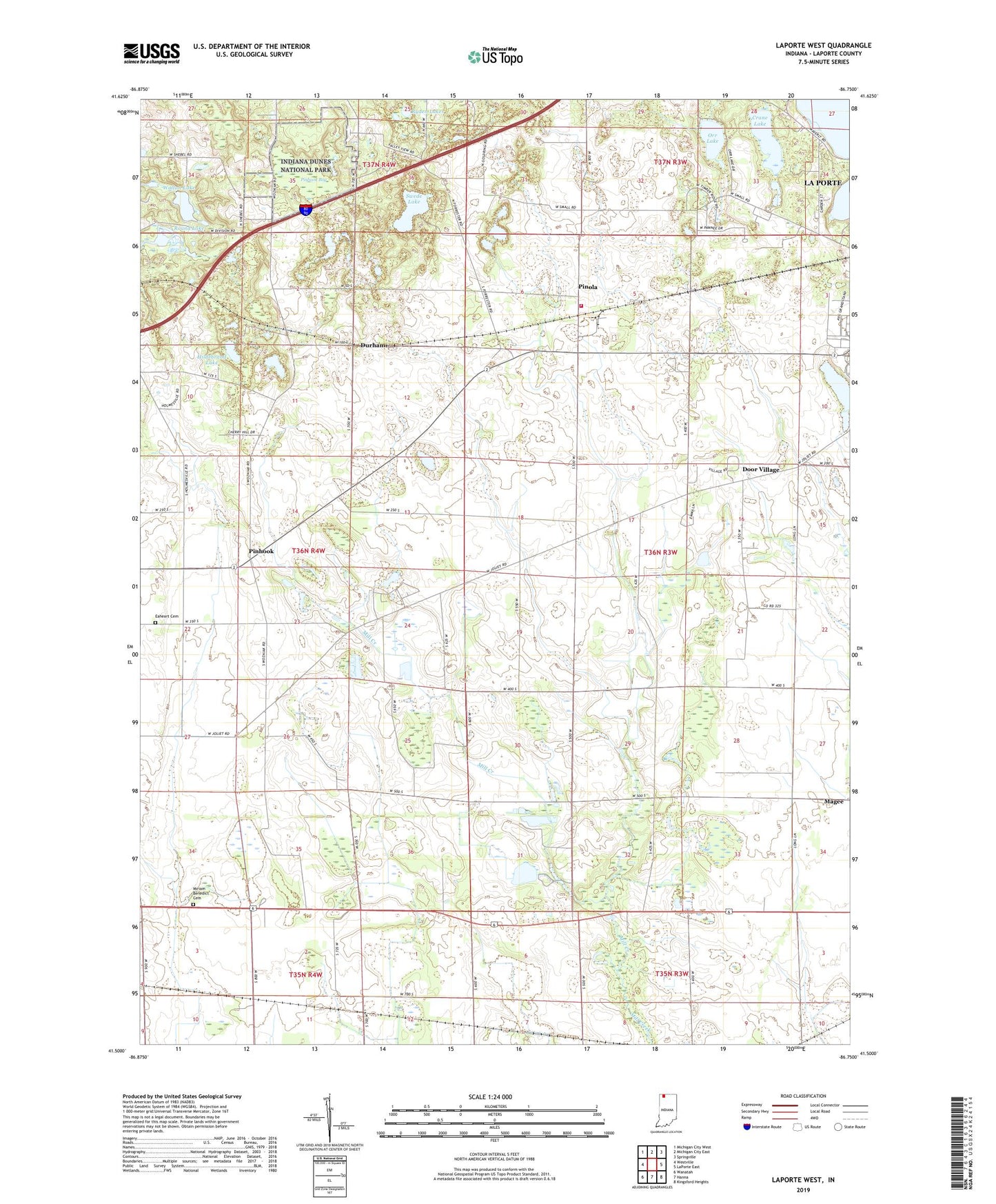
2022 topographic map quadrangle LaPorte West in the state of Indiana. Scale: 1:24000. Based on the newly updated USGS 7.5' US Topo map series, this map is in the following counties: LaPorte. The map contains contour data, water features, and other items you are used to seeing on USGS maps, but also has updated roads and other features. This is the next generation of topographic maps. Printed on high-quality waterproof paper with UV fade-resistant inks.
Quads adjacent to this one:
West: Westville
Northwest: Michigan City West
North: Michigan City East
Northeast: Springville
East: LaPorte East
Southeast: Kingsford Heights
South: Hanna
Southwest: Wanatah
Contains the following named places: Camp To-Pe-Ne-Bee, Carmel Chapel, Crane Lake, Door Village, Door Village Elementary School, Durham, Eaheart Cemetery, Hildebrand Lake, Laporte Fair Grounds, Magee, Miriam Benedict Cemetery, Orr Lake, Pinhook, Pinhook Bog, Pinola, Pretty Prairie Creek Road Dam, Ryden Lakes, Scipio Township Volunteer Fire Department Station 1, Soldiers Memorial Park, Swede Lake, Township of New Durham, Township of Scipio, Walton Lake, Walton Lake Dam