MyTopo
Hanna Indiana US Topo Map
Couldn't load pickup availability
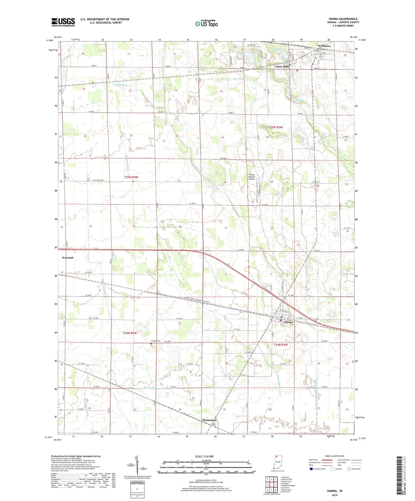
2022 topographic map quadrangle Hanna in the state of Indiana. Scale: 1:24000. Based on the newly updated USGS 7.5' US Topo map series, this map is in the following counties: LaPorte. The map contains contour data, water features, and other items you are used to seeing on USGS maps, but also has updated roads and other features. This is the next generation of topographic maps. Printed on high-quality waterproof paper with UV fade-resistant inks.
Quads adjacent to this one:
West: Wanatah
Northwest: Westville
North: LaPorte West
Northeast: LaPorte East
East: Kingsford Heights
Southeast: Knox West
South: English Lake
Southwest: La Crosse
This map covers the same area as the classic USGS quad with code o41086d7.
Contains the following named places: Bible Church, Conlon Arm, Flying U Ranch Airport, Gloor Ditch, Guse Arm, Hanna, Hanna Arm of Tuesburg Ditch, Hanna Census Designated Place, Hanna Post Office, Hanna Township Volunteer Fire Department, Hunsley Ditch, Morgan Cemetery, Noble Township Fire Department, O'Hara Ditch, Rice Ditch, Richman Ditch, Rosenbaum Arm, Saint Johns Church, Sheldon Arm, South Central Elementary School, South Central Junior-Senior High School, Thomaston, Township of Cass, Township of Clinton, Township of Noble, Union Mills, Union Mills Dam, Union Mills Lake, Union Mills Post Office, Wellsboro, Zion Church, ZIP Codes: 46340, 46382