MyTopo
Lynnville Indiana US Topo Map
Couldn't load pickup availability
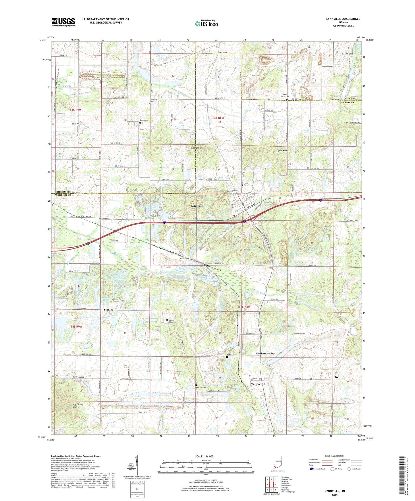
2023 topographic map quadrangle Lynnville in the state of Indiana. Scale: 1:24000. Based on the newly updated USGS 7.5' US Topo map series, this map is in the following counties: Warrick, Gibson, Pike. The map contains contour data, water features, and other items you are used to seeing on USGS maps, but also has updated roads and other features. This is the next generation of topographic maps. Printed on high-quality waterproof paper with UV fade-resistant inks.
Quads adjacent to this one:
West: Elberfeld
Northwest: Francisco
North: Oakland City
Northeast: Augusta
East: Folsomville
Southeast: De Gonia Springs
South: Boonville
Southwest: Daylight
This map covers the same area as the classic USGS quad with code o38087b3.
Contains the following named places: Barnetts Chapel, Big Ditney Hill, Dyson Knob, Eby, Eby Post Office, Eden Cemetery, Fletcher Chapel, Graham Valley, Kilpatrick Cemetery, Liberty Chapel, Little Creek, Lynnville, Lynnville Cemetery, Lynnville Elementary School, Lynnville Mine, Lynnville Post Office, Lynnville Town Marshal, Lynnville Volunteer Fire Department, Massey Cemetery, Morrison Cemetery, Mount Olive Cemetery, North Friendship Church, Plum Branch, Ringham Hill, Saint Matthews Church, Saint Pauls Cemetery, Stanley, Tecumseh Junior - Senior High School, Town of Lynnville, Township of Hart, Turpin Hill, Zion Church, ZIP Code: 47619