MyTopo
Oakland City Indiana US Topo Map
Couldn't load pickup availability
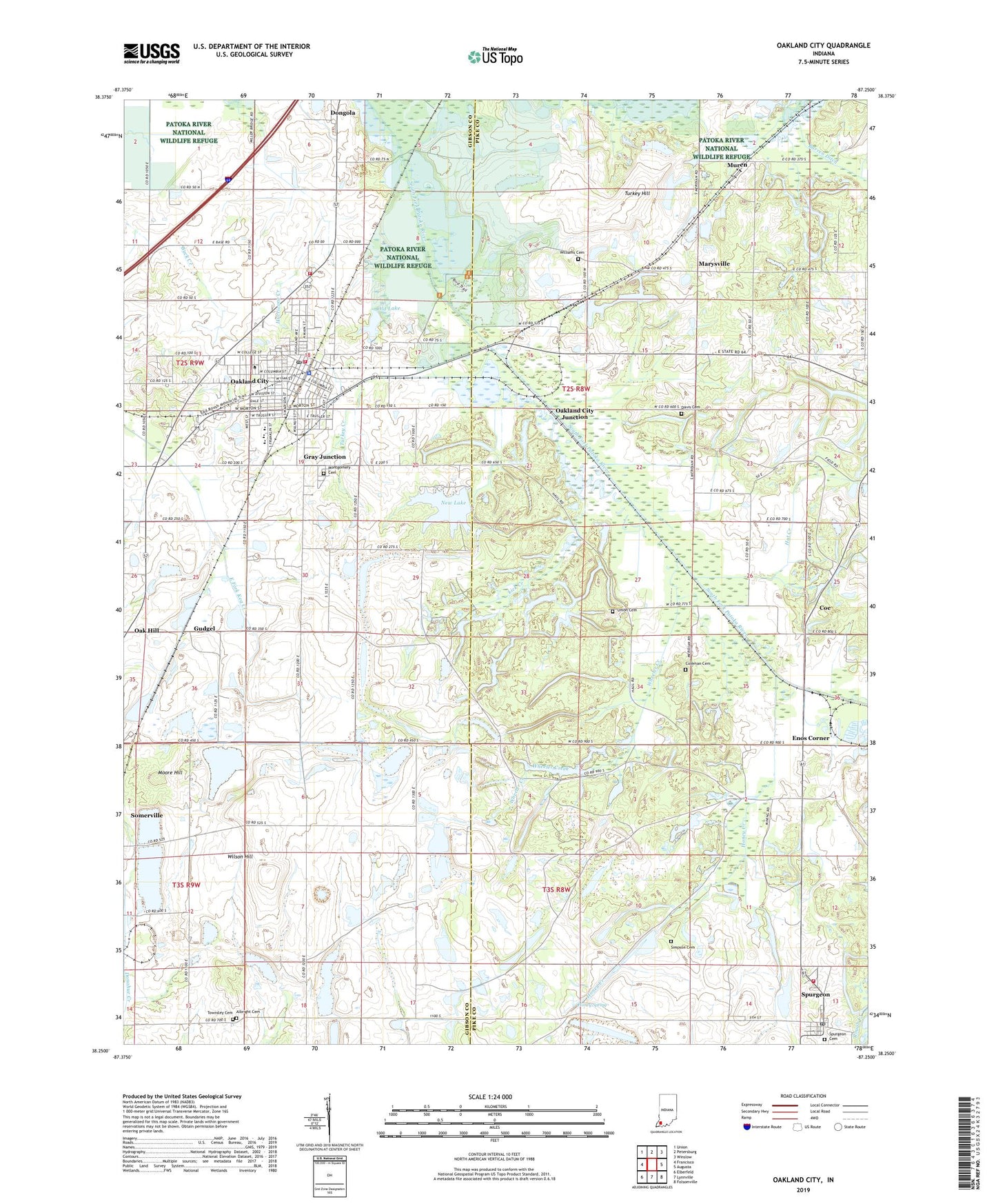
2022 topographic map quadrangle Oakland City in the state of Indiana. Scale: 1:24000. Based on the newly updated USGS 7.5' US Topo map series, this map is in the following counties: Pike, Gibson. The map contains contour data, water features, and other items you are used to seeing on USGS maps, but also has updated roads and other features. This is the next generation of topographic maps. Printed on high-quality waterproof paper with UV fade-resistant inks.
Quads adjacent to this one:
West: Francisco
Northwest: Union
North: Petersburg
Northeast: Winslow
East: Augusta
Southeast: Folsomville
South: Lynnville
Southwest: Elberfeld
This map covers the same area as the classic USGS quad with code o38087c3.
Contains the following named places: Albright Cemetery, Bakren Ditch, Blackfoot Church, City of Oakland City, Coe, Coleman Cemetery, Columbia Township Volunteer Fire Department, Davis Cemetery, Dongola, Enos Corner, Enos Mine, Friendship Church, Gibson County Emergency Medical Services Station 2, Gray Junction, Gudgel, Hat Creek, Honey Creek, Honey Spring, Jordan Park, Lick Creek, Marysville, McCullough Grove Church, McGregors Hill, Montgomery Cemetery, Moore Hill, Muren, New Lake, Oak Hill, Oakland City, Oakland City College, Oakland City Country Club, Oakland City Elementary School, Oakland City Fire Department, Oakland City Junction, Oakland City Police Department, Oakland City Post Office, Old Lake, Old Oakland City Lake Dam, Patoka River National Wildlife Refuge, Patoka State Fish and Wildlife Area, Potaka Grove Church, Simpson Cemetery, Somerville Mine, Spurgeon, Spurgeon Cemetery, Spurgeon Fire Department, Spurgeon Post Office, Town of Spurgeon, Township of Columbia, Township of Monroe, Townsley Cemetery, Turkey Creek, Turkey Hill, Union Cemetery, Waldo J Wood Memorial High School, Wheeler Creek, Williams Cemetery, Wilson Hill, Wirth Park, ZIP Codes: 47584, 47660