MyTopo
Francisco Indiana US Topo Map
Couldn't load pickup availability
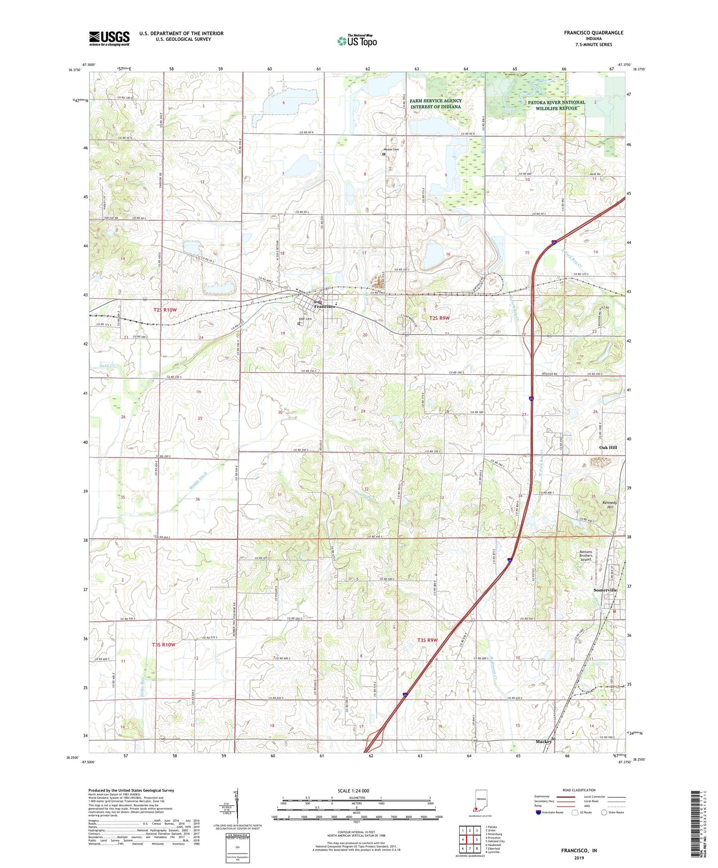
2022 topographic map quadrangle Francisco in the state of Indiana. Scale: 1:24000. Based on the newly updated USGS 7.5' US Topo map series, this map is in the following counties: Gibson, Pike. The map contains contour data, water features, and other items you are used to seeing on USGS maps, but also has updated roads and other features. This is the next generation of topographic maps. Printed on high-quality waterproof paper with UV fade-resistant inks.
Quads adjacent to this one:
West: Princeton
Northwest: Patoka
North: Union
Northeast: Petersburg
East: Oakland City
Southeast: Lynnville
South: Elberfeld
Southwest: Haubstadt
This map covers the same area as the classic USGS quad with code o38087c4.
Contains the following named places: Bottoms Brothers Airport, East Fork Keg Creek, Fairview Church, Forsythe Church, Francisco, Francisco Elementary School, Francisco Police Department, Francisco Post Office, Francisco Volunteer Fire Department, Halfmoon Ditch, Hollingsworth Airport, IOOF Cemetery, Kennedy Hill, Mackey, Mackey Elementary School, Mackey Post Office, Meade Cemetery, Muddy Ditch, Oak Grove Church, Providence Church, Saint Bernard Church, Saint Pauls Church, Somerville, Somerville Elementary School, Somerville Volunteer Fire Department, Town of Francisco, Town of Mackey, Town of Somerville, Township of Center, West Fork Keg Creek, ZIP Codes: 47649, 47683