MyTopo
Ossian Indiana US Topo Map
Couldn't load pickup availability
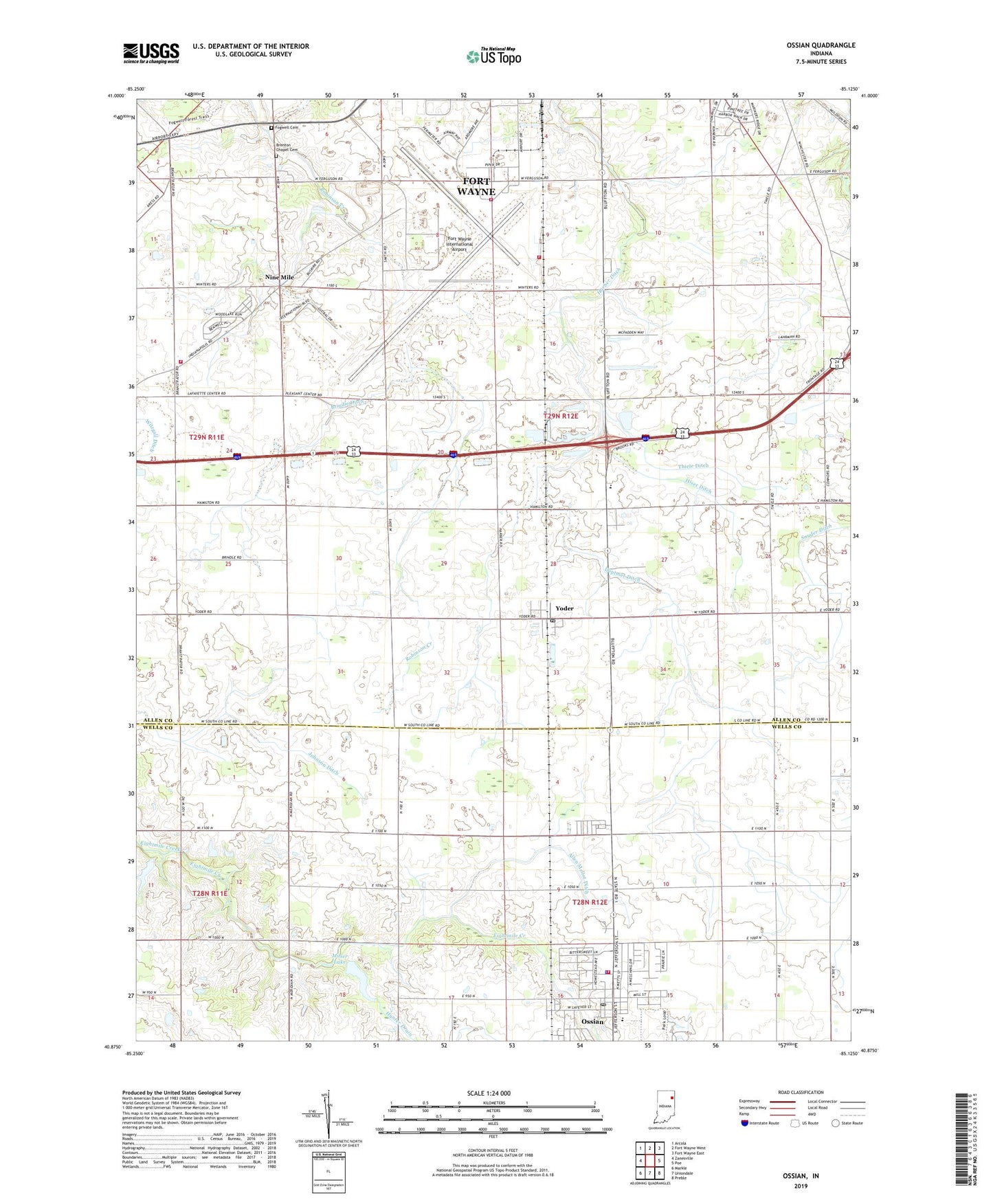
2022 topographic map quadrangle Ossian in the state of Indiana. Scale: 1:24000. Based on the newly updated USGS 7.5' US Topo map series, this map is in the following counties: Allen, Wells. The map contains contour data, water features, and other items you are used to seeing on USGS maps, but also has updated roads and other features. This is the next generation of topographic maps. Printed on high-quality waterproof paper with UV fade-resistant inks.
Quads adjacent to this one:
West: Zanesville
Northwest: Arcola
North: Fort Wayne West
Northeast: Fort Wayne East
East: Poe
Southeast: Preble
South: Uniondale
Southwest: Markle
This map covers the same area as the classic USGS quad with code o40085h2.
Contains the following named places: Allen Mellot Ditch, Bethel Church, Brenton Chapel Cemetery, Brindle Ditch, Deptmer Ditch, Fairview Church, Fogwell Cemetery, Fort Wayne - Allen County Airport Authority Safety Department, Fort Wayne International Airport, Harber Ditch, Hiser Ditch, Hunter Drain, Indiana Air National 122 Fighter Wing Fire and Rescue Department, Johnson Ditch, Moser Lake, Moser Lake Dam, Nine Mile, Ossian, Ossian Elementary School, Ossian Police Department, Ossian Post Office, Ossian Volunteer Fire Department, Saint Aloysius Catholic School, Saint Marks School, Southwest Allen County Fire Station 3 Base 250, Thiele Ditch, Town of Ossian, Township of Pleasant, Wilcox Airstrip, Woods Ditch, Yoder, Yoder Post Office, ZIP Codes: 46798, 46809, 46819