MyTopo
Uniondale Indiana US Topo Map
Couldn't load pickup availability
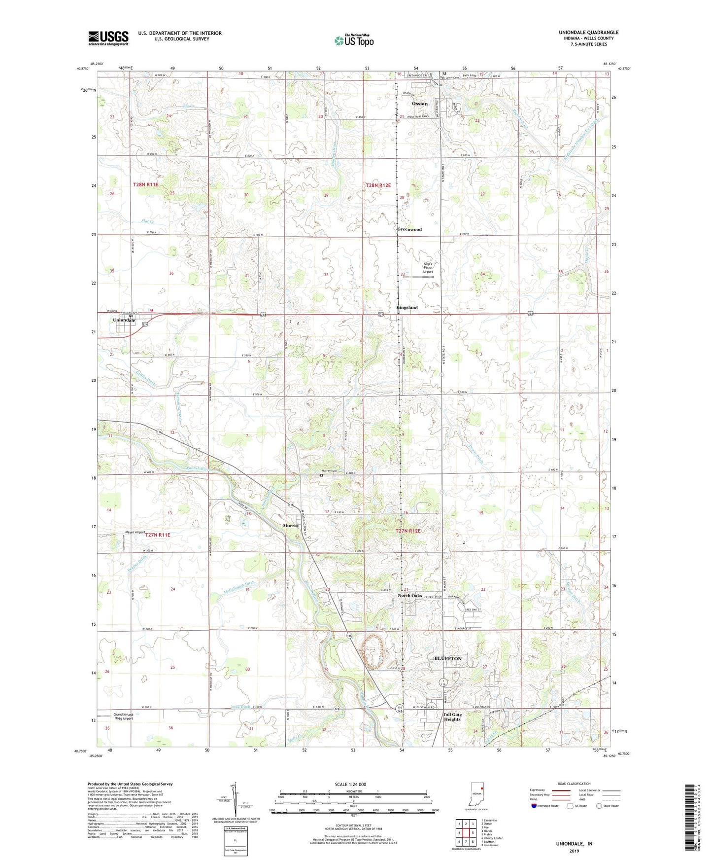
2022 topographic map quadrangle Uniondale in the state of Indiana. Scale: 1:24000. Based on the newly updated USGS 7.5' US Topo map series, this map is in the following counties: Wells. The map contains contour data, water features, and other items you are used to seeing on USGS maps, but also has updated roads and other features. This is the next generation of topographic maps. Printed on high-quality waterproof paper with UV fade-resistant inks.
Quads adjacent to this one:
West: Markle
Northwest: Zanesville
North: Ossian
Northeast: Poe
East: Preble
Southeast: Linn Grove
South: Bluffton
Southwest: Liberty Center
This map covers the same area as the classic USGS quad with code o40085g2.
Contains the following named places: Bender Ditch, Calvary Church, Dowty Ditch, Flemming Ditch, Grandlienard-Hogg Airport, Greenwood, Halls Creek, Johns Creek, Kingsland, Lancaster Central School, Lancaster Chapel, Lusk Ditch, Mayer Airport, McCullough Ditch, Murray, Murray Cemetery, Murray Conservation Club, North Oaks, Oak Lawn Cemetery, Prospect Church, Skip's Place Airport, Stewart Ditch, Toll Gate Heights, Toll Gate Rest Park, Town of Uniondale, Township of Jefferson, Township of Lancaster, Uniondale, Uniondale Post Office, Uniondale Volunteer Fire Department, ZIP Codes: 46777, 46791