MyTopo
Preble Indiana US Topo Map
Couldn't load pickup availability
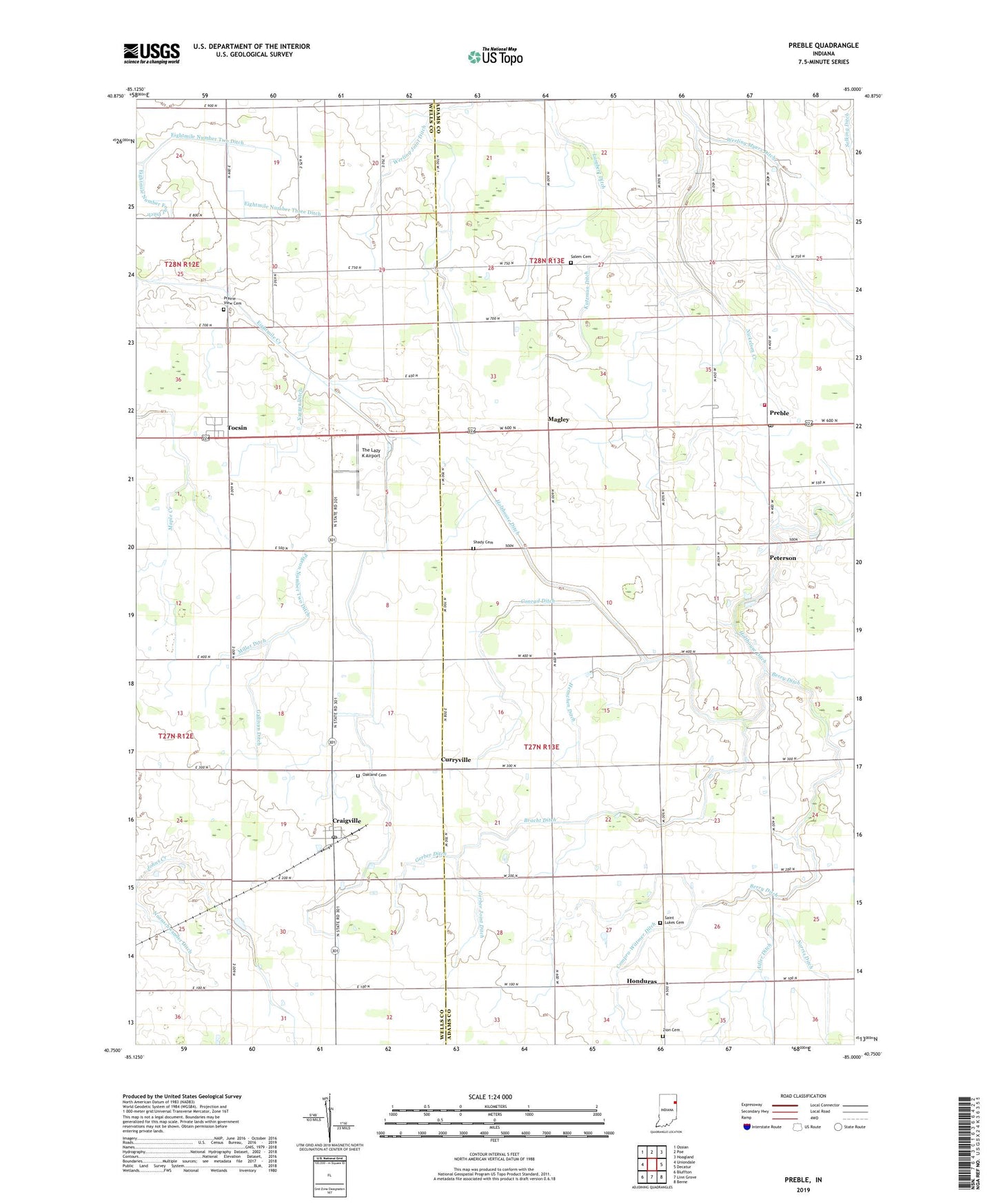
2022 topographic map quadrangle Preble in the state of Indiana. Scale: 1:24000. Based on the newly updated USGS 7.5' US Topo map series, this map is in the following counties: Adams, Wells. The map contains contour data, water features, and other items you are used to seeing on USGS maps, but also has updated roads and other features. This is the next generation of topographic maps. Printed on high-quality waterproof paper with UV fade-resistant inks.
Quads adjacent to this one:
West: Uniondale
Northwest: Ossian
North: Poe
Northeast: Hoagland
East: Decatur
Southeast: Berne
South: Linn Grove
Southwest: Bluffton
This map covers the same area as the classic USGS quad with code o40085g1.
Contains the following named places: Adler Ditch, Berry Ditch, Bethlehem Lutheran School, Bracht Ditch, Compro-Wittmer Ditch, Conrad Ditch, Craigville, Craigville Post Office, Curryville, Eightmile Number Four Ditch, Eightmile Number Three Ditch, Eightmile Number Two Ditch, Gallivan Ditch, Gerber Ditch, Gerber Joint Ditch, Heller Nursery, Henschen Ditch, Honduras, Kirkland Bible Institute, Kutzman Ditch, Magley, Maple Creek, Miller Ditch, Norris Ditch, Nuenschwander Ditch, Oakland Cemetery, Peterson, Pigeon Number Two Ditch, Pleasant Dale Church, Pleasant Valley Church, Prairie View Cemetery, Preble, Preble Post Office, Preble Volunteer Fire Department, Saint Lukes Cemetery, Saint Lukes Church, Saint Pauls School, Salem Cemetery, Salem Church, Shady Cemetery, Shel-Mar Farms, The Lazy K Airport, Tocsin, Township of Kirkland, Township of Preble, Werling Myers Ditch, Yarger Ditch, Zion Cemetery, ZIP Code: 46731