MyTopo
Owensville Indiana US Topo Map
Couldn't load pickup availability
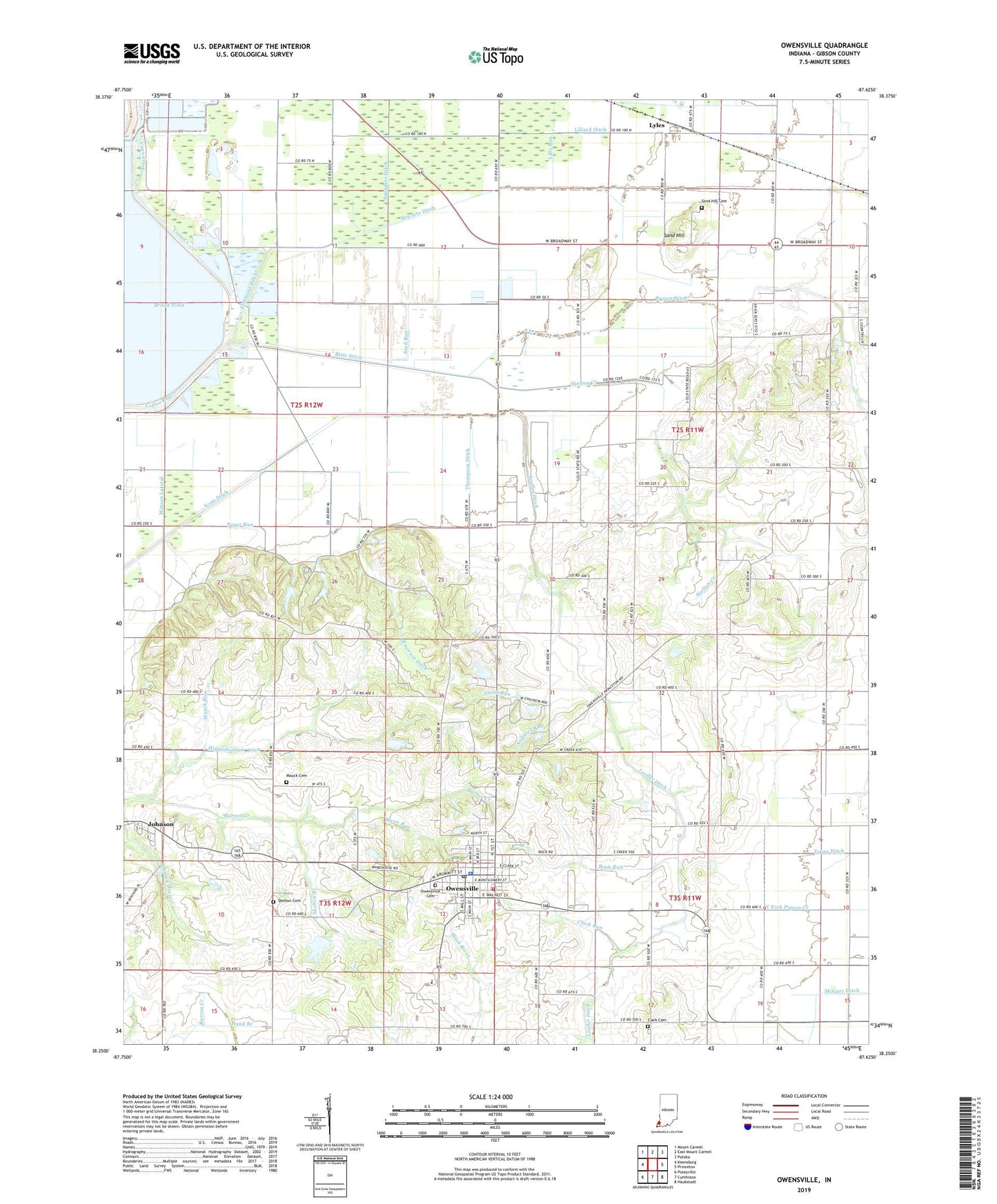
2022 topographic map quadrangle Owensville in the state of Indiana. Scale: 1:24000. Based on the newly updated USGS 7.5' US Topo map series, this map is in the following counties: Gibson. The map contains contour data, water features, and other items you are used to seeing on USGS maps, but also has updated roads and other features. This is the next generation of topographic maps. Printed on high-quality waterproof paper with UV fade-resistant inks.
Quads adjacent to this one:
West: Keensburg
Northwest: Mount Carmel
North: East Mount Carmel
Northeast: Patoka
East: Princeton
Southeast: Haubstadt
South: Cynthiana
Southwest: Poseyville
This map covers the same area as the classic USGS quad with code o38087c6.
Contains the following named places: Andrews Run, Barren Creek, Blair Ditch, Book Run, Clark Cemetery, Clark Run, Coffee Bayou, Coon Creek, David Run, Emerson Ditch, Gibson County Emergency Medical Services Station 5, Hand Branch, Johnson, Lillard Ditch, Lilly Run, Loefler Ditch, Lyles, Mauck Cemetery, Mauck Run, McCarty Ditch, McGary, McGary Ditch, Montgomery Ditch, Owen Run, Owensville, Owensville - Montgomery Township Fire Protection District Owensville Station, Owensville Cemetery, Owensville Police Department, Owensville Post Office, Owensville Public School, Paper Run, Richland Church, Sand Hill, Sand Hill Cemetery, Saunders Ditch, Seed Run, Skelton Branch, Skelton Cemetery, Skelton Creek, Smith Run, Stormont Ditch, Thompson Ditch, Town of Owensville, Township of Montgomery, Watson Lateral, ZIP Code: 47665