MyTopo
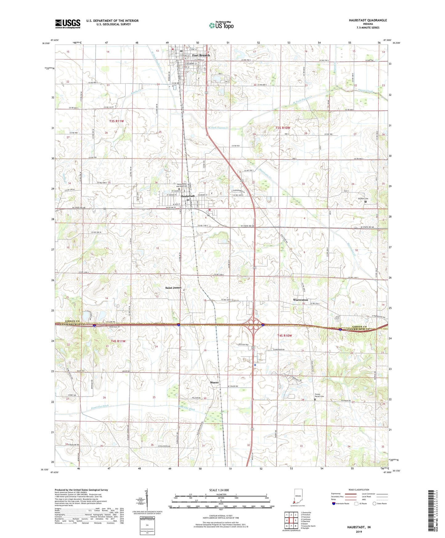
Haubstadt Indiana US Topo Map
Couldn't load pickup availability
2022 topographic map quadrangle Haubstadt in the state of Indiana. Scale: 1:24000. Based on the newly updated USGS 7.5' US Topo map series, this map is in the following counties: Gibson, Vanderburgh. The map contains contour data, water features, and other items you are used to seeing on USGS maps, but also has updated roads and other features. This is the next generation of topographic maps. Printed on high-quality waterproof paper with UV fade-resistant inks.
Quads adjacent to this one:
West: Cynthiana
Northwest: Owensville
North: Princeton
Northeast: Francisco
East: Elberfeld
Southeast: Daylight
South: Evansville North
Southwest: Kasson
This map covers the same area as the classic USGS quad with code o38087b5.
Contains the following named places: Buente Creek, Fort Branch / Union Township Fire Department Station 1, Fort Branch Post Office, Gibson County Emergency Medical Services Station 4, Haubstadt, Haubstadt Community School, Haubstadt Fire Territory, Haubstadt Post Office, Hurricane Creek, Hurricane Creek Ditch, Immanuel Church, Indiana State Police, Pond Flat Ditch, Saint James, Saint Stephen Church, Saints Peter and Paul Cemetery, Sandy Creek, Stacer, Stunkel Cemetery, Thrust Industries Airport, Town of Fort Branch, Town of Haubstadt, Township of Johnson, Township of Union, Trinity Parish Cemetery, Warrenton, West Fork Pigeon Creek, ZIP Codes: 47639, 47648