MyTopo
Cynthiana Indiana US Topo Map
Couldn't load pickup availability
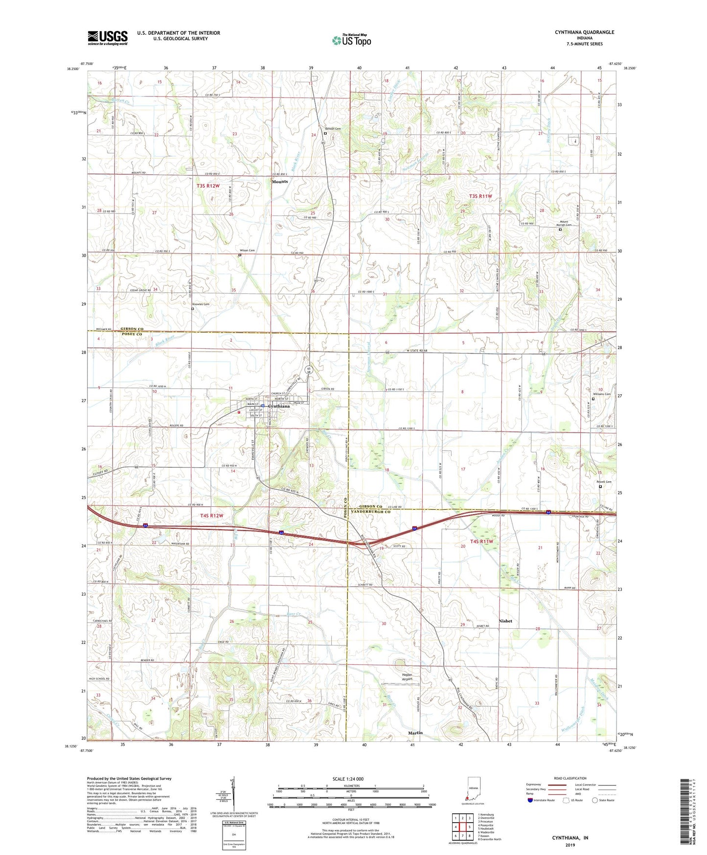
2022 topographic map quadrangle Cynthiana in the state of Indiana. Scale: 1:24000. Based on the newly updated USGS 7.5' US Topo map series, this map is in the following counties: Gibson, Posey, Vanderburgh. The map contains contour data, water features, and other items you are used to seeing on USGS maps, but also has updated roads and other features. This is the next generation of topographic maps. Printed on high-quality waterproof paper with UV fade-resistant inks.
Quads adjacent to this one:
West: Poseyville
Northwest: Keensburg
North: Owensville
Northeast: Princeton
East: Haubstadt
Southeast: Evansville North
South: Kasson
Southwest: Wadesville
This map covers the same area as the classic USGS quad with code o38087b6.
Contains the following named places: Antioch Church, Barr Creek, Benson Cemetery, Blythe Chapel, Calverts Chapel, Clay Hill Jersey Farm, Cynthiana, Cynthiana Police Department, Cynthiana Post Office, Hepler Airport, Jordan Creek, Knowles Cemetery, McGray Ditch, Mount Moriah Cemetery, Mount Pleasant Church, Mounts, New Liberty Church, Newman Lateral, Nisbet, Powell Cemetery, Smith Township Volunteer Fire Department, Town of Cynthiana, Township of Armstrong, Township of Smith, Williams Cemetery, Wilson Cemetery, ZIP Code: 47612