MyTopo
Richland City Indiana US Topo Map
Couldn't load pickup availability
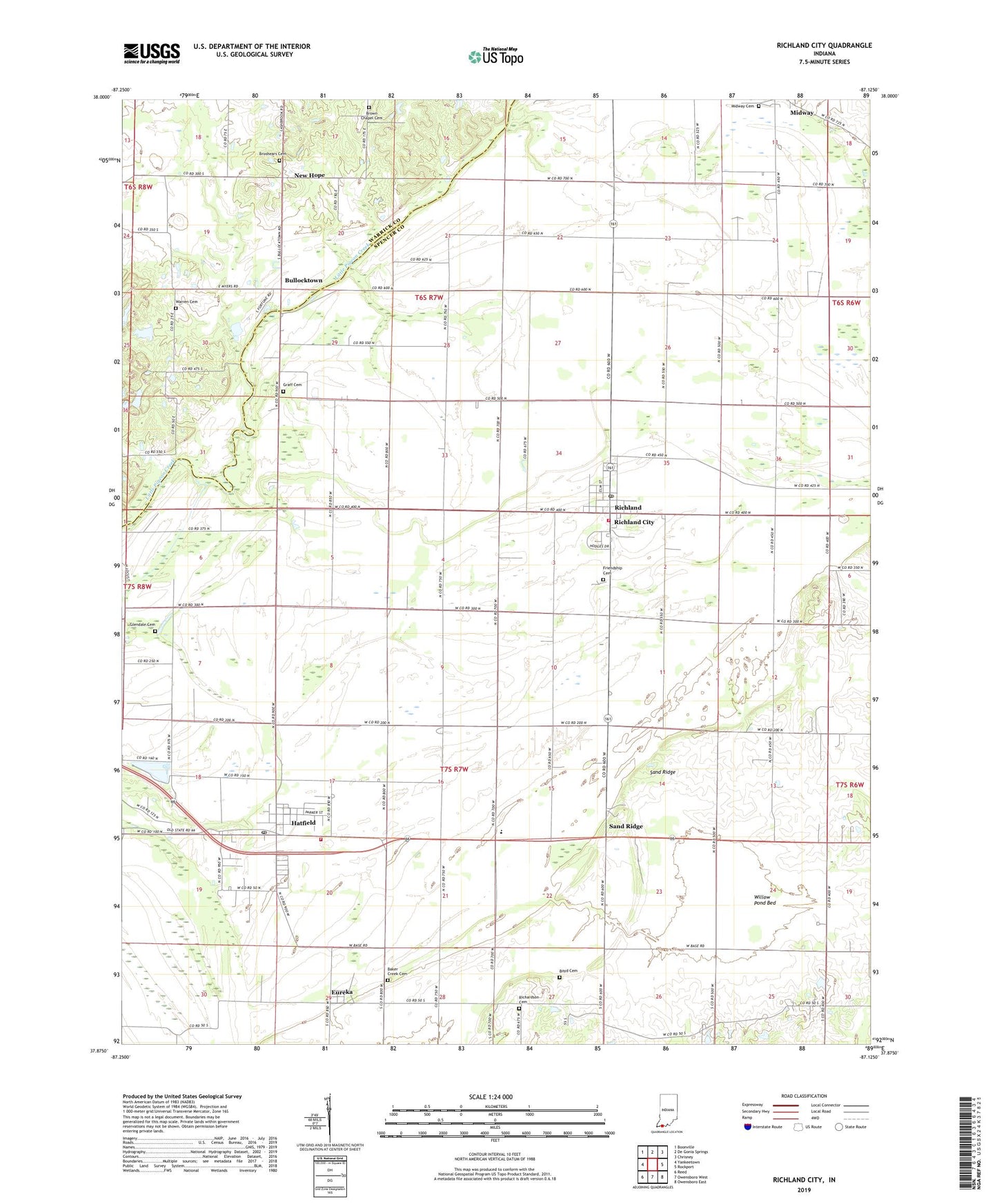
2022 topographic map quadrangle Richland City in the state of Indiana. Scale: 1:24000. Based on the newly updated USGS 7.5' US Topo map series, this map is in the following counties: Spencer, Warrick. The map contains contour data, water features, and other items you are used to seeing on USGS maps, but also has updated roads and other features. This is the next generation of topographic maps. Printed on high-quality waterproof paper with UV fade-resistant inks.
Quads adjacent to this one:
West: Yankeetown
Northwest: Boonville
North: De Gonia Springs
Northeast: Chrisney
East: Rockport
Southeast: Owensboro East
South: Owensboro West
Southwest: Reed
This map covers the same area as the classic USGS quad with code o37087h2.
Contains the following named places: Baker Creek Cemetery, Boyd Cemetery, Brauns Airport, Broshears Cemetery, Brown Chapel Cemetery, Bullocktown, Caney Creek, Ebenezer Church, Eureka, Friendship Cemetery, Glendale Cemetery, Graff Cemetery, Hatfield, Hatfield Census Designated Place, Hatfield Drain, Hatfield Fire Department, Hatfield Post Office, Hooppole Ditch, Lake Drain, Long Pond Ditch, Luce Elementary School, Luce Township Fire Department Station 2, Luce Township Volunteer Fire Department, McCoy Drain, Midway, Midway Cemetery, Mount Zion Church, Muddy Creek, New Hope, Renshaw Airport, Richardson Cemetery, Richland City, Richland Post Office, Rose Pond Ditch, Sand Ridge, Sweezer Ditch, Tower Ditch, Town of Richland, Township of Luce, Warren Cemetery, Willow Pond Bed, Willow Pond Ditch, ZIP Code: 47634