MyTopo
Reed Kentucky US Topo Map
Couldn't load pickup availability
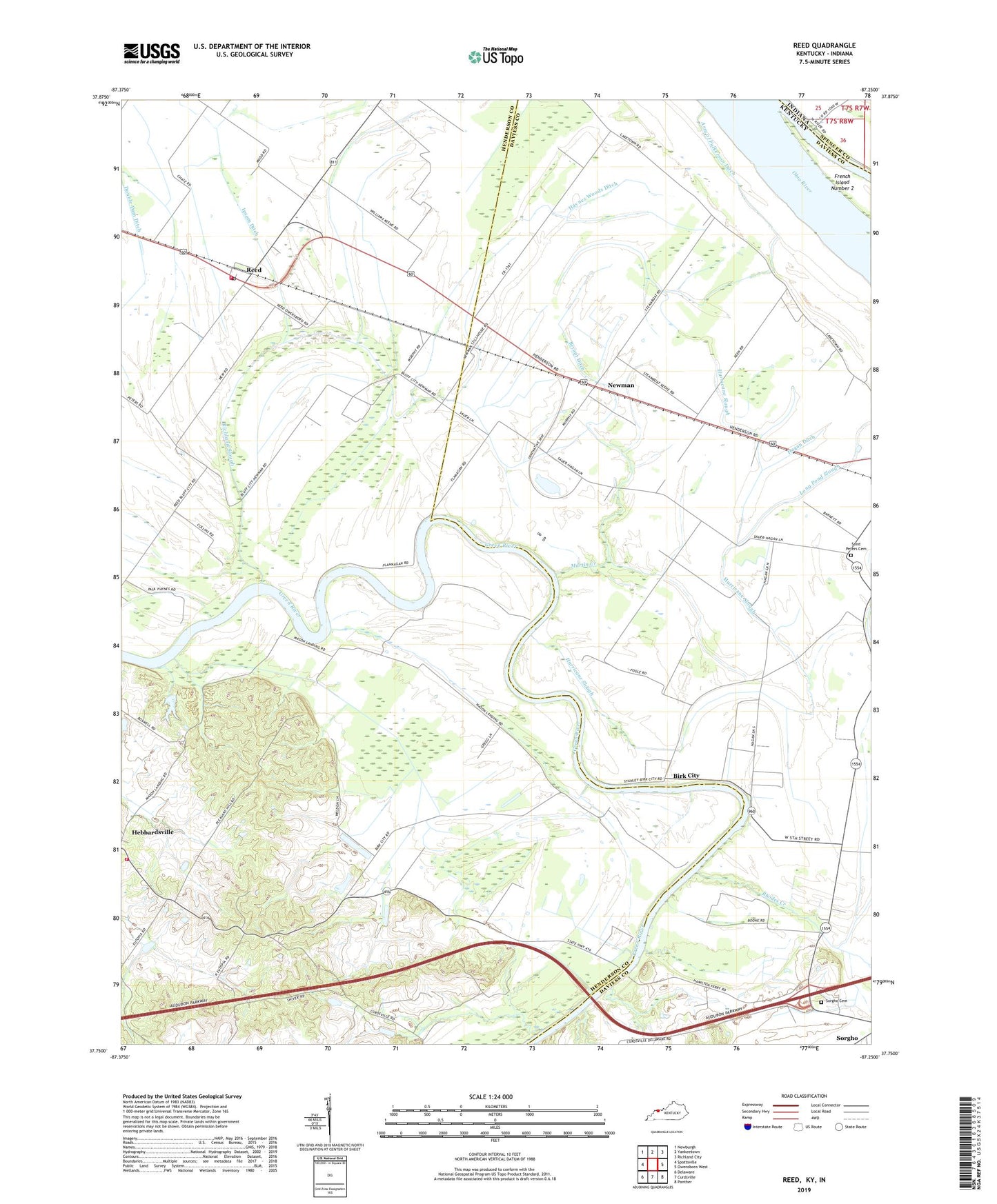
2022 topographic map quadrangle Reed in the state of Kentucky. Scale: 1:24000. Based on the newly updated USGS 7.5' US Topo map series, this map is in the following counties: Henderson, Daviess, Spencer. The map contains contour data, water features, and other items you are used to seeing on USGS maps, but also has updated roads and other features. This is the next generation of topographic maps. Printed on high-quality waterproof paper with UV fade-resistant inks.
Quads adjacent to this one:
West: Spottsville
Northwest: Newburgh
North: Yankeetown
Northeast: Richland City
East: Owensboro West
Southeast: Panther
South: Curdsville
Southwest: Delaware
This map covers the same area as the classic USGS quad with code o37087g3.
Contains the following named places: Bethel Church, Birk City, Bryant Ditch, Double Dam Ditch, Fulkerson Ditch, Gilleyville Church, Hagan Ditch, Haynes Woods Ditch, Hebbardsville Area Volunteer Fire Department, Hurricane Slough, Ipsom Ditch, Katie Meadow Slough, Little Flock Church, Long Pond Slough, Martin Creek, Mount Zion Church, Newman, Pleasant Hill Church, Reed, Reed Fire Department, Reed Post Office, Rhodes Creek, Richland Slough, Saint Peters Cemetery, Saint Peters School, Sauer, Sloughs Wildlife Management Area, Sorgho Cemetery, WKOH-TV (Owensboro), WKPB-FM (Henderson), WSTO-FM (Owensboro)