MyTopo
Richvalley Indiana US Topo Map
Couldn't load pickup availability
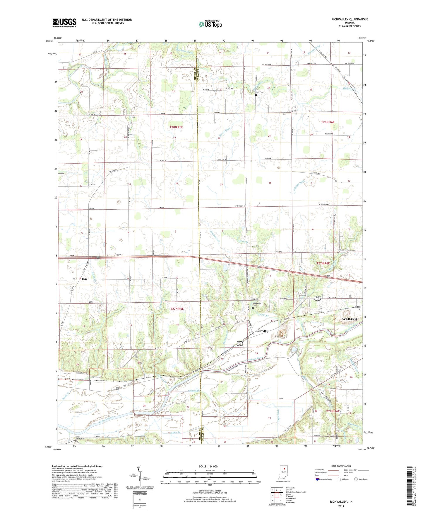
2022 topographic map quadrangle Richvalley in the state of Indiana. Scale: 1:24000. Based on the newly updated USGS 7.5' US Topo map series, this map is in the following counties: Wabash, Miami. The map contains contour data, water features, and other items you are used to seeing on USGS maps, but also has updated roads and other features. This is the next generation of topographic maps. Printed on high-quality waterproof paper with UV fade-resistant inks.
Quads adjacent to this one:
West: Peru
Northwest: Deedsville
North: Roann
Northeast: North Manchester South
East: Wabash
Southeast: Somerset
South: Peoria
Southwest: Bunker Hill
This map covers the same area as the classic USGS quad with code o40085g8.
Contains the following named places: Asher Branch, Bachelor Creek, Beamer Ditch, Busick Ditch, Carlin Branch, Center Chapel, Engleman Creek, Erie, Francis Godfroy Cemetery, Gilbert Branch, Higley Curve Gravel Pit, Huff Cemetery, Johnson Ditch, Kentner Creek, Mill Creek, Paw Paw Creek, Reserve Number Eleven, Reserve Number Thirteen, Reserve Number Twelve, Richvalley, Richvalley Cemetery, Ridgeway Creek, Schrom Creek, Stauffer Ditch, Township of Erie, Unger Ditch, Wallace Cemetery