MyTopo
Peru Indiana US Topo Map
Couldn't load pickup availability
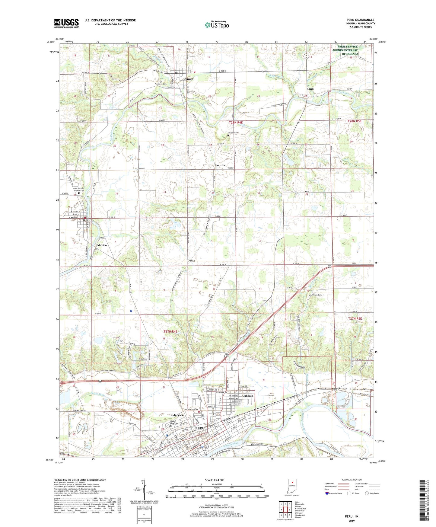
2022 topographic map quadrangle Peru in the state of Indiana. Scale: 1:24000. Based on the newly updated USGS 7.5' US Topo map series, this map is in the following counties: Miami. The map contains contour data, water features, and other items you are used to seeing on USGS maps, but also has updated roads and other features. This is the next generation of topographic maps. Printed on high-quality waterproof paper with UV fade-resistant inks.
Quads adjacent to this one:
West: Twelve Mile
Northwest: Macy
North: Deedsville
Northeast: Roann
East: Richvalley
Southeast: Peoria
South: Bunker Hill
Southwest: Onward
This map covers the same area as the classic USGS quad with code o40086g1.
Contains the following named places: Benner Field, Central Elementary School, Chili, City of Peru, Courter, Courter Cemetery, Daniel Creek, Denver, Denver Post Office, Denver Town Marshal, Denver Volunteer Fire Department, Doyle, Dukes Memorial Hospital, Elmwood Elementary School, Flowers Creek, Hidden Hills, Kickapoo Stone Quarry, Lincoln Elementary School, Little Weesau Creek, Mexico, Mexico Census Designated Place, Mexico Fire Department, Mexico Post Office, Miami County, Miami County Sheriff's Office, Missisinewa, Mississinewa Country Club, Mississinewa River, Mount Hope Cemetery, Oakdale, Old German Baptist Cemetery, Peru, Peru Fire Department Station 2, Peru High School, Peru Police Department, Peru Post Office, Prairie Ditch, Richland School, Ridgeview, Ridgeview School, Rush Strip, Saint Charles School, Saint John Lutheran School, Shrock Cemetery, Shrock Creek, Town of Denver, Township of Jefferson, Township of Peru, Township of Richland, Victory Elementary School, WARU-AM (Peru), WARU-FM (Peru), Washonis Creek, Weesau Creek, Westlawn Cemetery, ZIP Codes: 46958, 46970