MyTopo
Bunker Hill Indiana US Topo Map
Couldn't load pickup availability
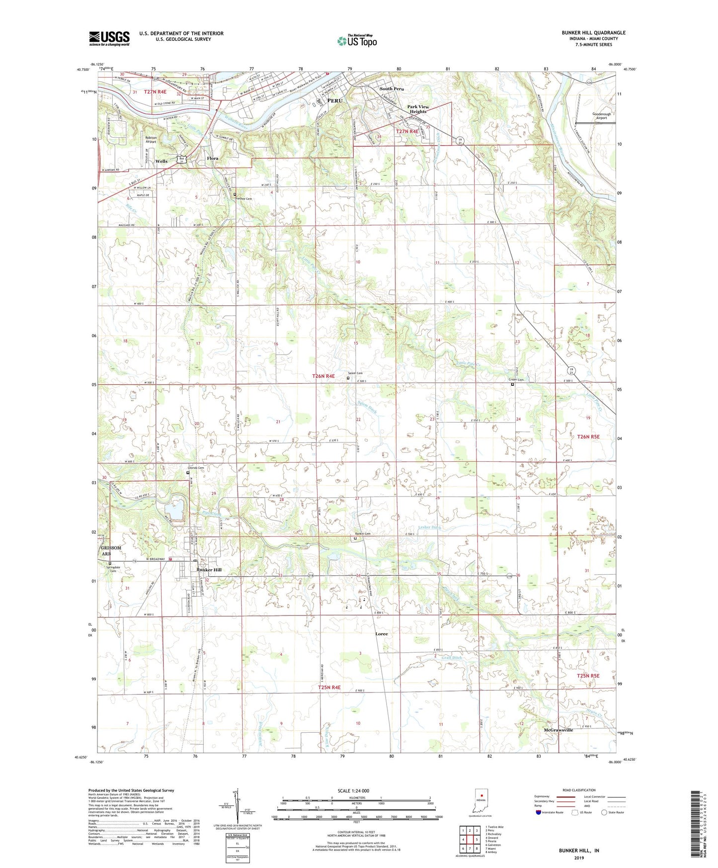
2022 topographic map quadrangle Bunker Hill in the state of Indiana. Scale: 1:24000. Based on the newly updated USGS 7.5' US Topo map series, this map is in the following counties: Miami. The map contains contour data, water features, and other items you are used to seeing on USGS maps, but also has updated roads and other features. This is the next generation of topographic maps. Printed on high-quality waterproof paper with UV fade-resistant inks.
Quads adjacent to this one:
West: Onward
Northwest: Twelve Mile
North: Peru
Northeast: Richvalley
East: Peoria
Southeast: Amboy
South: Miami
Southwest: Galveston
This map covers the same area as the classic USGS quad with code o40086f1.
Contains the following named places: Bunker Hill, Bunker Hill Elementary School, Bunker Hill Post Office, Crider Cemetery, Emmanuel Church, Flora, Goodenough Airport, Graff Ditch, Holman Elementary School, Leonda Cemetery, Lesher Ditch, Liberty School, Little Pipe Creek, Loree, Maconaquah Elementary School, Maconaquah High School, Maconaquah Middle School, Maconaquah Park, McGrawsville, Miami County Emergency Management Agency, Midway Church, Miller Strip Airport, Nead Elementary School, Negro Creek, Oakley, Park View Heights, Peru Fire Department Station 1, Pipe Creek Township Volunteer Fire Department, Rankin Cemetery, Robison Airport, Salem Cemetery, Salem Church, Salem Ditch, Schoolman Ditch, Sharpee Cemetery, Shinn Bone Lane Airport, South Peru, Springdale Cemetery, Town of Bunker Hill, Township of Washington, Wells, West City Park, ZIP Code: 46914