MyTopo
Riverwood Indiana US Topo Map
Couldn't load pickup availability
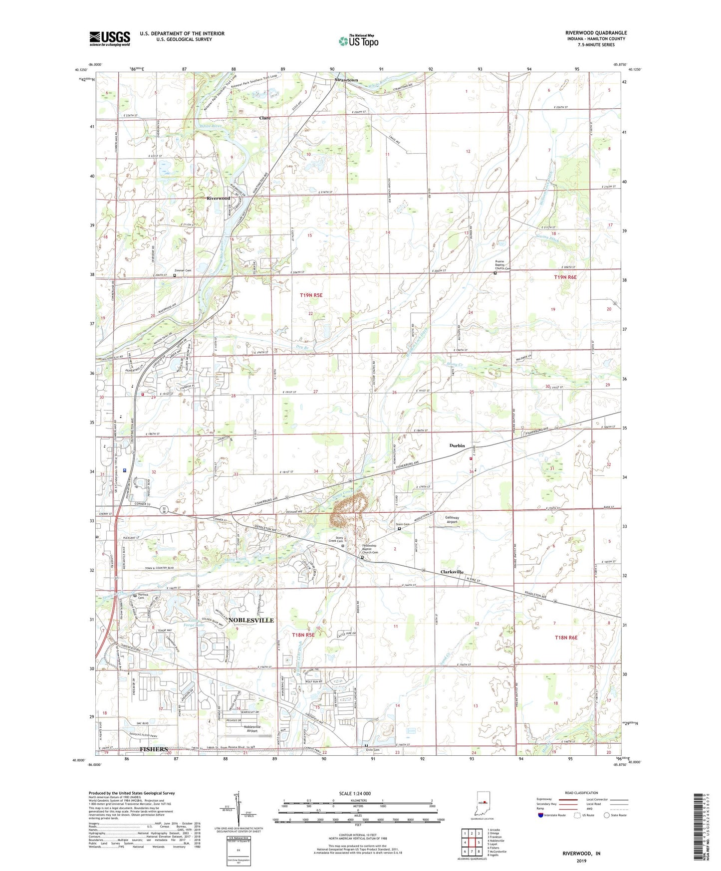
2022 topographic map quadrangle Riverwood in the state of Indiana. Scale: 1:24000. Based on the newly updated USGS 7.5' US Topo map series, this map is in the following counties: Hamilton. The map contains contour data, water features, and other items you are used to seeing on USGS maps, but also has updated roads and other features. This is the next generation of topographic maps. Printed on high-quality waterproof paper with UV fade-resistant inks.
Quads adjacent to this one:
West: Noblesville
Northwest: Arcadia
North: Omega
Northeast: Frankton
East: Lapel
Southeast: Ingalls
South: McCordsville
Southwest: Fishers
This map covers the same area as the classic USGS quad with code o40085a8.
Contains the following named places: Bethel Church, Boulevard Bay, Canal Way Pond, Clare, Clarksville, Clarksville Christian Church, Consolidated School, Creekside Farm Airport, Dry Branch, Durbin, Durbin Elementary School, Emmanuel United Methodist Church, Ervin Cemetery, Fellowship Baptist Church Cemetery, First United Methodist Church, Galloway Airport, Gwinn Ditch, Hamilton County Sheriff's Office, Harger Farms, Hurlock Cemetery, Lock Ditch, Meadows Glen, Meadows Knoll, Noblesville Airport, Noblesville Commons Shopping Center, Noblesville Creek Shoppes Shopping Center, Noblesville Fire Department Station 75, Noblesville High School, Noblesville Post Office, Options Charter School - Noblesville, Poole Airport, Prairie Baptist Church Cemetery, Prairie Church, Refuge Church, Riverwood, Riverwood Power Dam, Roberts-Jacobi Restricted Airport, School Number 1, School Number 10, School Number 11, School Number 12, School Number 13, School Number 2, School Number 3, School Number 4, School Number 5, School Number 6, School Number 7, School Number 8, School Number 9, Stern Cemetery, Stony Creek Cemetery, Stonycreek Farm Nursery, Strawtown, Swan Lake, Town And Country Plaza Shopping Center, Township of Wayne, Triangle Lagoon, Union Church, Valley Forge Lake, Valley Forge Lake Dam, Victory Chapel, Wayne Township Volunteer Fire Department, White River Elementary School, WHMB-TV (Indianapolis), William Lehr Ditch, William Lock Ditch, Zimmer Cemetery, ZIP Code: 46060