MyTopo
Russellville Indiana US Topo Map
Couldn't load pickup availability
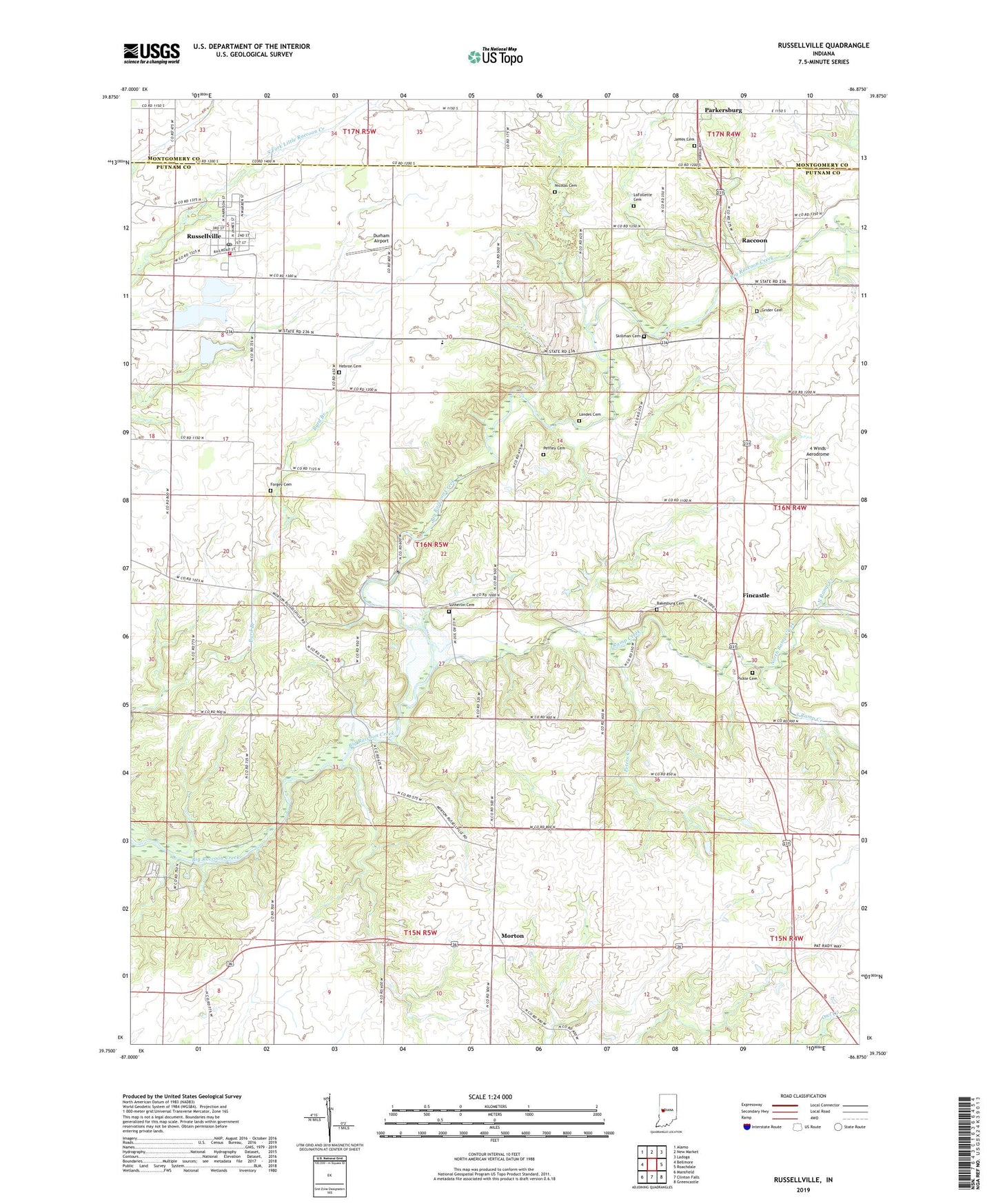
2022 topographic map quadrangle Russellville in the state of Indiana. Scale: 1:24000. Based on the newly updated USGS 7.5' US Topo map series, this map is in the following counties: Putnam, Montgomery. The map contains contour data, water features, and other items you are used to seeing on USGS maps, but also has updated roads and other features. This is the next generation of topographic maps. Printed on high-quality waterproof paper with UV fade-resistant inks.
Quads adjacent to this one:
West: Bellmore
Northwest: Alamo
North: New Market
Northeast: Ladoga
East: Roachdale
Southeast: Greencastle
South: Clinton Falls
Southwest: Mansfield
This map covers the same area as the classic USGS quad with code o39086g8.
Contains the following named places: 4 Winds Aerodrome, 46175, Bakesburg Cemetery, Blakesburg, Durham Airport, Fincastle, Forgey Cemetery, Grider Cemetery, Hebron Cemetery, James Cemetery, LaFollette Cemetery, Landes Cemetery, Morton, Nicolas Cemetery, North Ramp Creek, Parkersburg, Peffley Cemetery, Peters Creek, Pickle Cemetery, Raccoon, Ramp Creek, Russellville, Russellville and Community Volunteer Fire Department, Russellville Elementary School, Russellville Post Office, Russellville Town Marshal's Office, Skillman Cemetery, South Ramp Creek, Sutherlin Cemetery, Town of Russellville, Township of Russell, Union Chapel