MyTopo
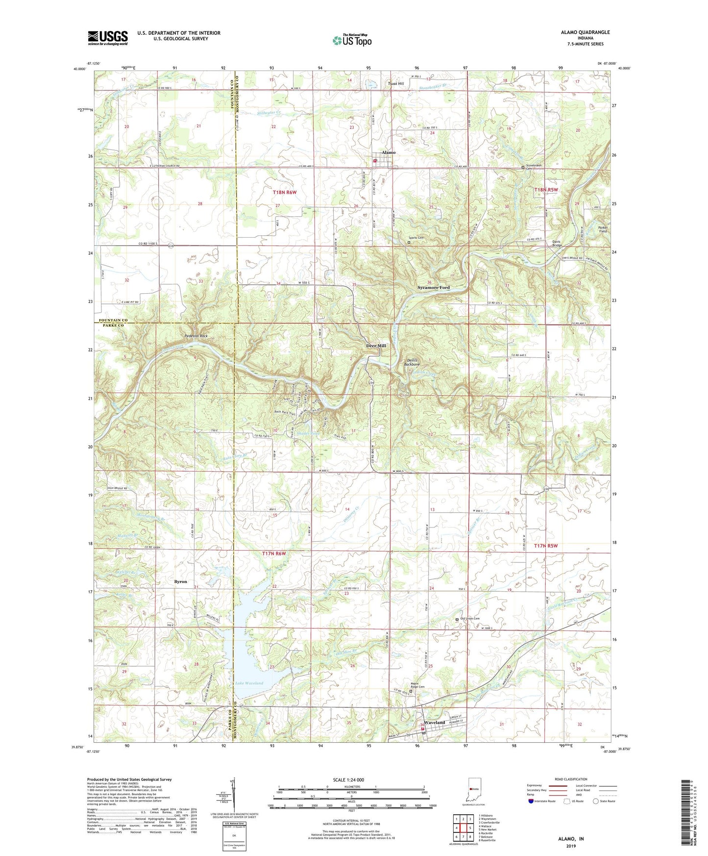
Alamo Indiana US Topo Map
Couldn't load pickup availability
2022 topographic map quadrangle Alamo in the state of Indiana. Scale: 1:24000. Based on the newly updated USGS 7.5' US Topo map series, this map is in the following counties: Montgomery, Parke, Fountain. The map contains contour data, water features, and other items you are used to seeing on USGS maps, but also has updated roads and other features. This is the next generation of topographic maps. Printed on high-quality waterproof paper with UV fade-resistant inks.
Quads adjacent to this one:
West: Wallace
Northwest: Hillsboro
North: Waynetown
Northeast: Crawfordsville
East: New Market
Southeast: Russellville
South: Bellmore
Southwest: Rockville
This map covers the same area as the classic USGS quad with code o39087h1.
Contains the following named places: Alamo, Alamo Conservation Club, Alamo Post Office, Banner Mills, Big Branch, Byron, Cold Spring Camp, Compton Branch, Corner Creek, Davis Branch, Davis Bridge, Deer Mill, Devils Backbone, Freedom Church, Indian Creek, Karnes Creek, Lake Waveland, Lake Waveland Park, Liberty School, Little Raccoon Structure Number 8, Maple Ridge Cemetery, Old Shoe Branch, Old Union Cemetery, Pedestal Rock, Rass Clore Branch, Ripley Township Volunteer Fire Department, Shades Pond, Shades Pond Dam, Shades State Park, Shades State Park Airport, Sloan Ditch, Smith Branch, Sparks Cemetery, Spencer Branch, Stonebraker Branch, Stonebraker Cemetery, Sycamore Ford, Town of Alamo, Town of Waveland, Township of Brown, Township of Ripley, Truax Hill, Waveland, Waveland Elementary School, Waveland Post Office, Waveland Volunteer Fire Department, ZIP Codes: 47916, 47989