MyTopo
Dennison Illinois US Topo Map
Couldn't load pickup availability
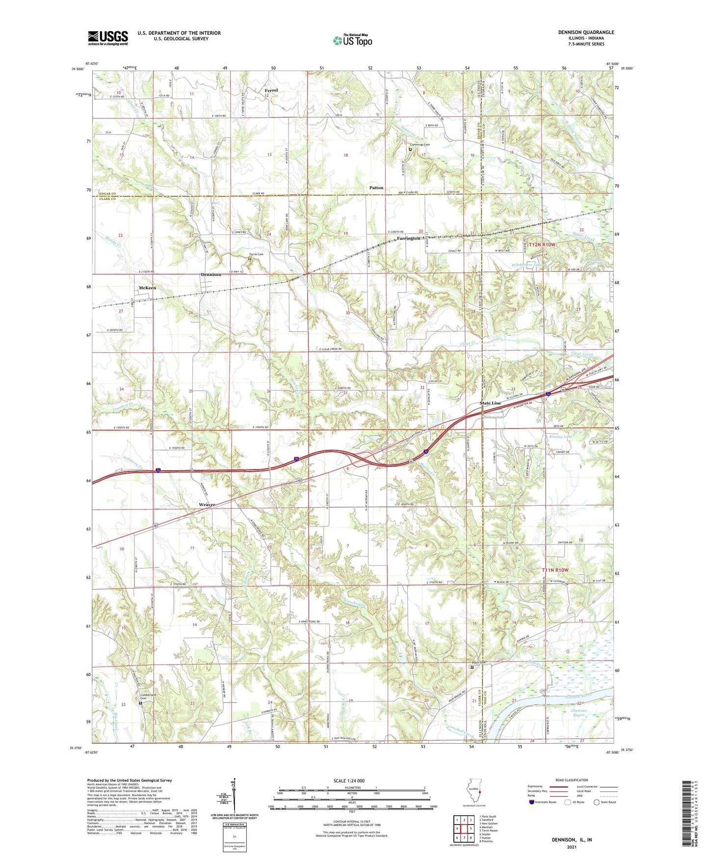
2024 topographic map quadrangle Dennison in the states of Illinois, Indiana. Scale: 1:24000. Based on the newly updated USGS 7.5' US Topo map series, this map is in the following counties: Clark, Vigo, Edgar. The map contains contour data, water features, and other items you are used to seeing on USGS maps, but also has updated roads and other features. This is the next generation of topographic maps. Printed on high-quality waterproof paper with UV fade-resistant inks.
Quads adjacent to this one:
West: Marshall
Northwest: Paris South
North: Sandford
Northeast: New Goshen
East: Terre Haute
Southeast: Pimento
South: Hutton
Southwest: Snyder
Contains the following named places: Armstrong United Methodist Church, Black Cemetery, Camp Illana, Chestnut Bayou, Clear Creek, Crooked Creek, Cumberland Cemetery, Cummings Cemetery, Dennison, Dennison Cemetery, Dennison Post Office, Dunlap United Methodist Church, Farrington, Farris Cemetery, Ferrel, Fishbach School, Hawks Creek, Illinois No Name Number 2043 Dam, Illinois No Name Number 2043 Reservoir, Kendall School, Kieweg Lake, Kieweg Lake Dam, McKeen, Mud Creek, Nelson Post Office, Patton, Patton United Methodist Church, Pleasant Grove School, Pleasant Hill School, Salem School, State Line, Sugar Creek, Township of Wabash, Union School, Wanda Lake, Wanda Lake Dam, Weaver, West Little Sugar Creek, Windemere Lake, Windmere Lake Dam, ZIP Code: 62423