MyTopo
Spartanburg Indiana US Topo Map
Couldn't load pickup availability
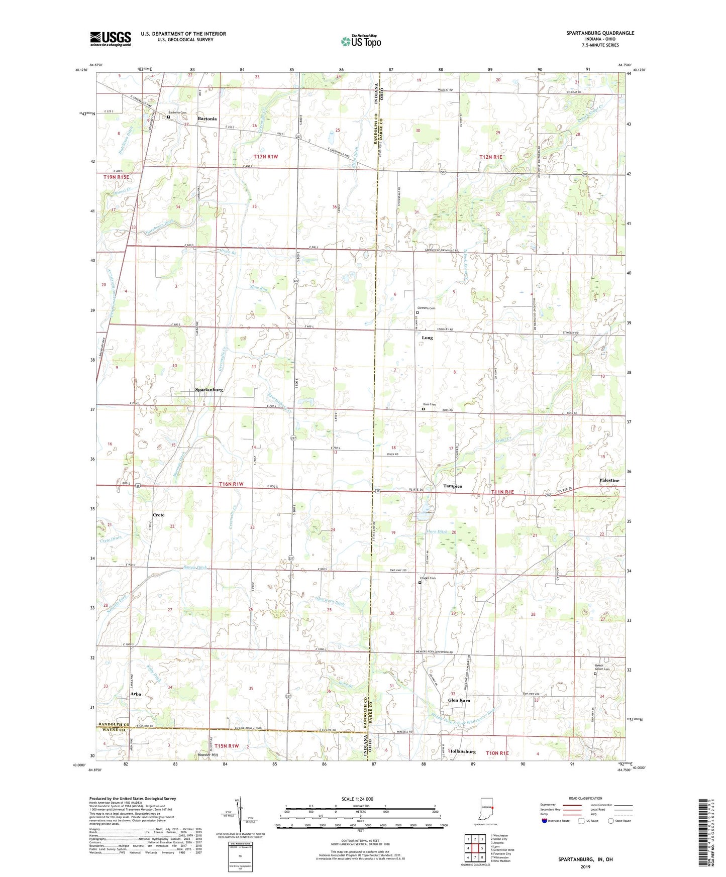
2022 topographic map quadrangle Spartanburg in the states of Indiana, Ohio. Scale: 1:24000. Based on the newly updated USGS 7.5' US Topo map series, this map is in the following counties: Randolph, Darke, Wayne. The map contains contour data, water features, and other items you are used to seeing on USGS maps, but also has updated roads and other features. This is the next generation of topographic maps. Printed on high-quality waterproof paper with UV fade-resistant inks.
Quads adjacent to this one:
West: Lynn
Northwest: Winchester
North: Union City
Northeast: Ansonia
East: Greenville West
Southeast: New Madison
South: Whitewater
Southwest: Fountain City
Contains the following named places: A K Farms, Arba, Armstrong Anderson Ditch, Baker Angus Farm, Bartonia, Bartonia Cemetery, Bartonia Run, Bass Cemetery, Beech Grove Cemetery, Beech Grove Church of the Brethren, Blair Farms, Bowen Ditch, Chapel Cemetery, Clemens Cemetery, Crete, Crete Drain, Dobson School, Elm Hill School, Elson Ditch, Glen Karn, Glen Karn Ditch, Glenkarn Post Office, Green Branch, Greene Farms, Harshman Ditch, Hoosier Hill, Horn Ditch, Hutchison Ditch, J K Farm, Karn Branch, Long, Long Post Office, Martin Dairy, Morman Ditch, Northfork Farms, Sauerkraut School, School Number 12, School Number 7, Slow Run, Spartanburg, Spartanburg Creek, Special School Number 3, Tampico, Tampico Post Office, Tampico School, Township of Greensfork, Township of Liberty, Wildcat Woods Estates