MyTopo
Winchester Indiana US Topo Map
Couldn't load pickup availability
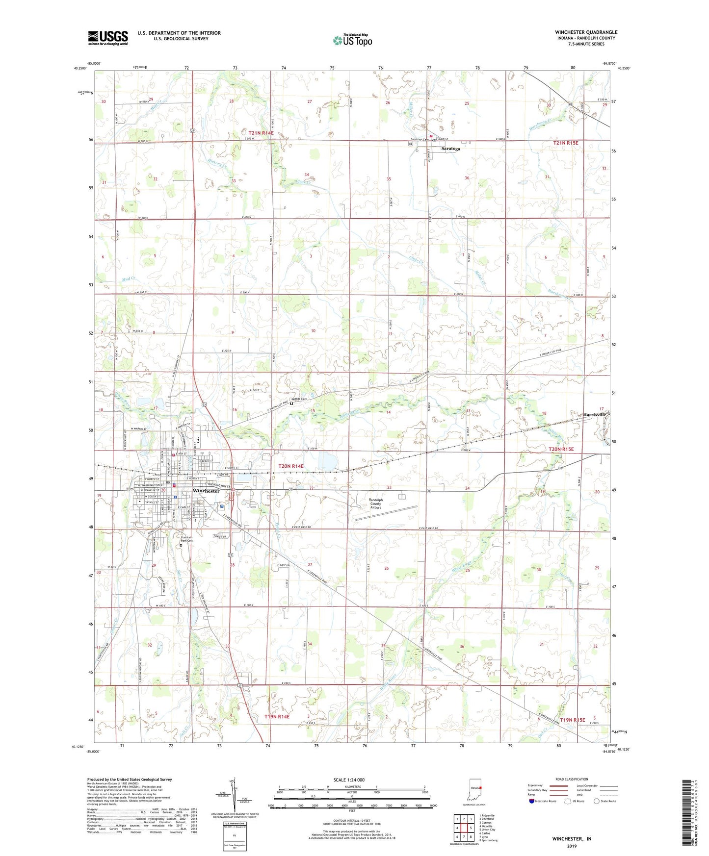
2022 topographic map quadrangle Winchester in the state of Indiana. Scale: 1:24000. Based on the newly updated USGS 7.5' US Topo map series, this map is in the following counties: Randolph. The map contains contour data, water features, and other items you are used to seeing on USGS maps, but also has updated roads and other features. This is the next generation of topographic maps. Printed on high-quality waterproof paper with UV fade-resistant inks.
Quads adjacent to this one:
West: Maxville
Northwest: Ridgeville
North: Deerfield
Northeast: Cosmos
East: Union City
Southeast: Spartanburg
South: Lynn
Southwest: Carlos
This map covers the same area as the classic USGS quad with code o40084b8.
Contains the following named places: Airline Twin Drive-In, City of Winchester, Clear Creek Church, Fountain Park Cemetery, Goodrich Park, Gospel Church, Harrisville, Hickory Creek, Jericho Church, Lee L Driver Junior High School, Moffitt Cemetery, Mount Zion Church, O R Baker Elementary School, Oliver P Morton Elementary School, Owl Creek, Peach Creek, Randolph County Airport, Randolph County Emergency Medical Services, Randolph County Sheriff's Office, Saint Vincent Randolph Hospital, Salt Creek, Saratoga, Saratoga Airport, Saratoga Cemetery, Saratoga Post Office, Shelley Ditch, Sugar Creek, Town of Saratoga, Ward Township Volunteer Fire Department, Ward-Jackson School, Wesleyan Church, White River Township Fire Department, Willard Elementary School, Winchester, Winchester Community High School, Winchester Fire Department, Winchester Police Department, Winchester Post Office, WZZY-FM (Winchester), ZIP Codes: 47382, 47394