MyTopo
Tampico Indiana US Topo Map
Couldn't load pickup availability
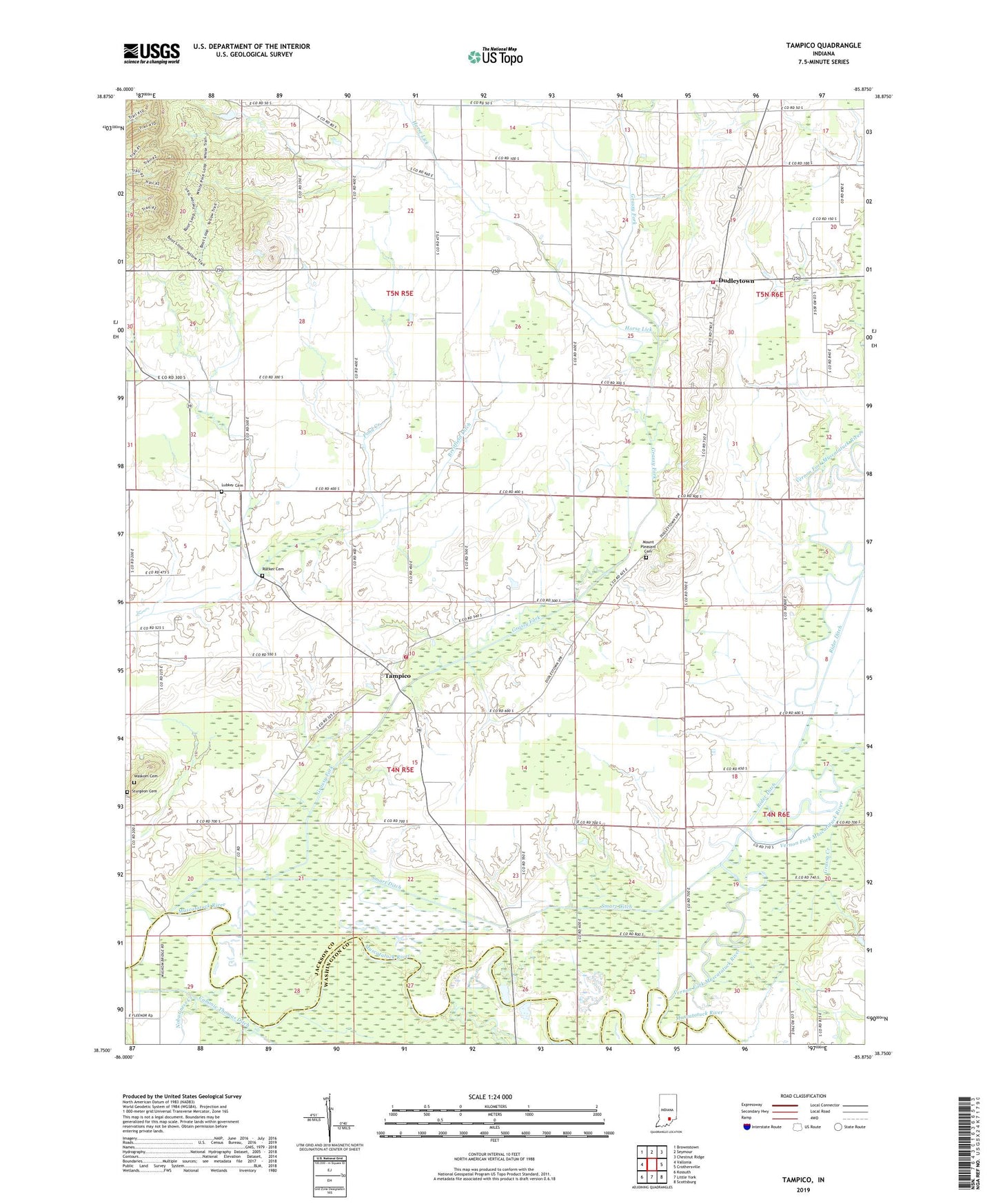
2022 topographic map quadrangle Tampico in the state of Indiana. Scale: 1:24000. Based on the newly updated USGS 7.5' US Topo map series, this map is in the following counties: Jackson, Washington. The map contains contour data, water features, and other items you are used to seeing on USGS maps, but also has updated roads and other features. This is the next generation of topographic maps. Printed on high-quality waterproof paper with UV fade-resistant inks.
Quads adjacent to this one:
West: Vallonia
Northwest: Brownstown
North: Seymour
Northeast: Chestnut Ridge
East: Crothersville
Southeast: Scottsburg
South: Little York
Southwest: Kossuth
This map covers the same area as the classic USGS quad with code o38085g8.
Contains the following named places: Breitfield Ditch, Cox School, Dudleytown, Dudleytown Conservation Club, Emanuel School, Grassy Creek, Grassy Fork, Grassy Fork Township Volunteer Fire Department, Hendersons Ferry, Horse Lick, Jackson - Washington Volunteer Fire Department - Dudleytown, Lubker Cemetery, Mount Pleasant Cemetery, Nobusiness Creek, Rucker Cemetery, Ruckers Ferry, Russell Chapel, Smart Ditch, Sturgeon Cemetery, Tampico, Township of Grassy Fork, Township of Washington, Vernon Fork Muscatatuck River, Waskom Cemetery