MyTopo
Little York Indiana US Topo Map
Couldn't load pickup availability
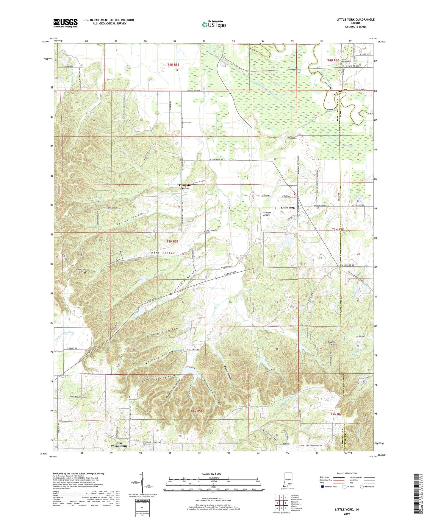
2022 topographic map quadrangle Little York in the state of Indiana. Scale: 1:24000. Based on the newly updated USGS 7.5' US Topo map series, this map is in the following counties: Washington, Scott, Jackson. The map contains contour data, water features, and other items you are used to seeing on USGS maps, but also has updated roads and other features. This is the next generation of topographic maps. Printed on high-quality waterproof paper with UV fade-resistant inks.
Quads adjacent to this one:
West: Kossuth
Northwest: Vallonia
North: Tampico
Northeast: Crothersville
East: Scottsburg
Southeast: Henryville
South: South Boston
Southwest: Salem
This map covers the same area as the classic USGS quad with code o38085f8.
Contains the following named places: Bane Hollow, Cammie Thomas Ditch, Dowling Hollow, Elk Creek, Elk Creek Fish and Game Area, Elk Creek Public Fishing Area, Elk Creek Structure Number 3, Elk Creek Structure Number 7, Elk Creek Structure Number 8, Frank Garrett Hollow, Georgetown, Gibson Township Little York Volunteer Fire Department, Gooseport, Herron Hollow, Little York, Little York Airport, McKnight Hollow, Monroe Hollow, New Philadelphia, Nowing Hollow, Pumpkin Center, Ridlen Cemetery, Rutherford Hollow, Shantaky Hollow, Smith Hollow, Steep Hollow Cemetery, Town of Little York, Township of Gibson, Vic Swaim Hill, Weddell Creek