MyTopo
Vallonia Indiana US Topo Map
Couldn't load pickup availability
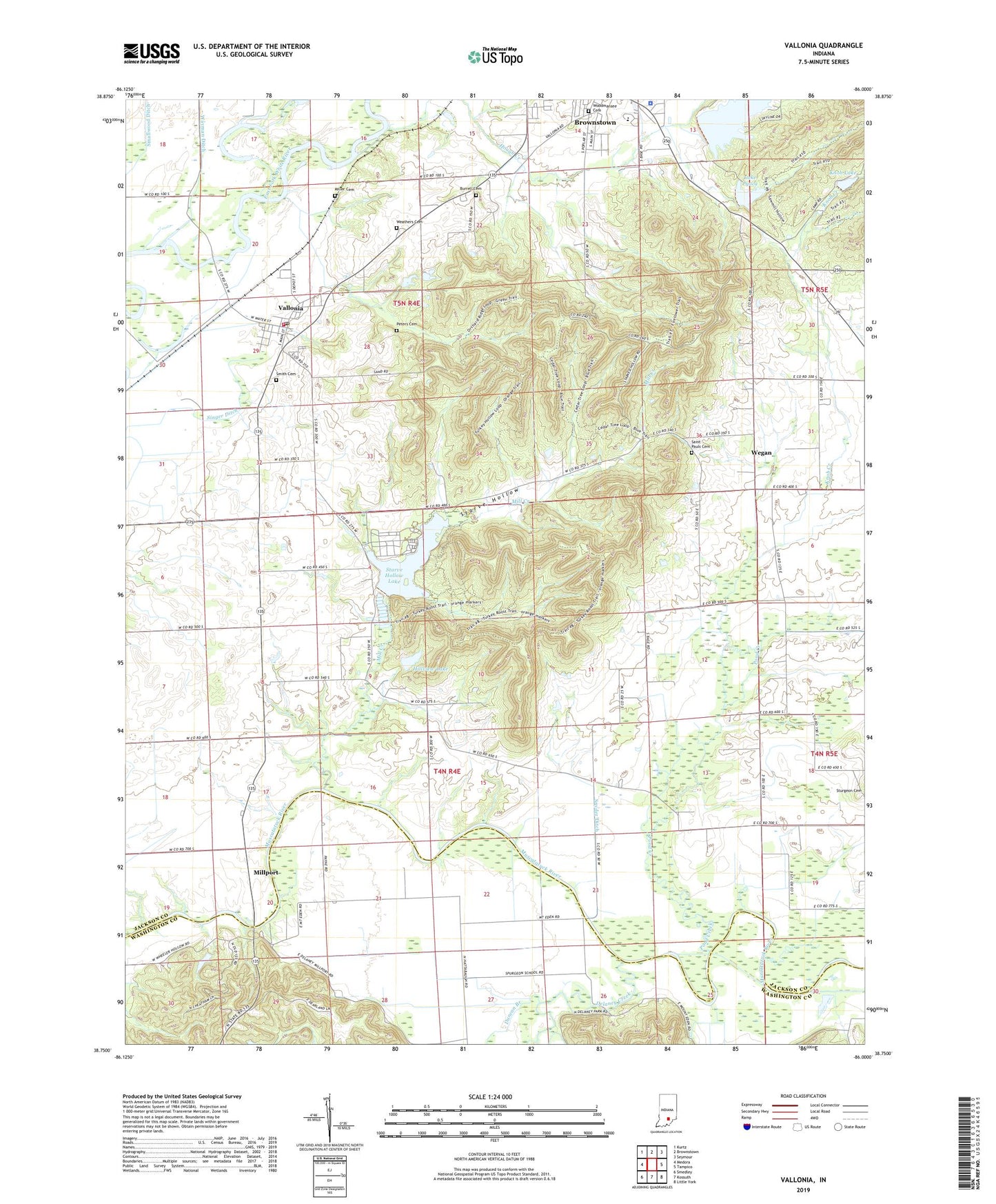
2022 topographic map quadrangle Vallonia in the state of Indiana. Scale: 1:24000. Based on the newly updated USGS 7.5' US Topo map series, this map is in the following counties: Jackson, Washington. The map contains contour data, water features, and other items you are used to seeing on USGS maps, but also has updated roads and other features. This is the next generation of topographic maps. Printed on high-quality waterproof paper with UV fade-resistant inks.
Quads adjacent to this one:
West: Medora
Northwest: Kurtz
North: Brownstown
Northeast: Seymour
East: Tampico
Southeast: Little York
South: Kossuth
Southwest: Smedley
This map covers the same area as the classic USGS quad with code o38086g1.
Contains the following named places: Burrell Cemetery, Camp Pyoca, De Laneys Creek Post Office, Delaney Creek, Driftwood Church, Driftwood Volunteer Fire Department, Duncan Branch, Hillview Lake, Hillview Lake Dam, Hough Creek, Jackson County Sheriff's Office, Jackson-Washington State Forest, Knob Creek, Knob Lake, Knob Lake Saw-Mill Hollow Dam, Lake Pyoca, Lake Pyoca Dam, Mill Creek, Miller Cemetery, Millport, Peters Cemetery, Pond Creek, Saint Pauls Cemetery, Saint Pauls School, Singer Ditch, Smallwood Ditch, Smith Cemetery, Snyder Ditch, Starve Hollow, Starve Hollow Lake, Starve Hollow Lake Dam, Starve Hollow State Beach, Stockwisch Ditch, Township of Driftwood, Vallonia, Vallonia Census Designated Place, Vallonia Church, Vallonia Post Office, Weathers Cemetery, Wegan, Woodmansee Cemetery, ZIP Code: 47281