MyTopo
Twelve Mile Indiana US Topo Map
Couldn't load pickup availability
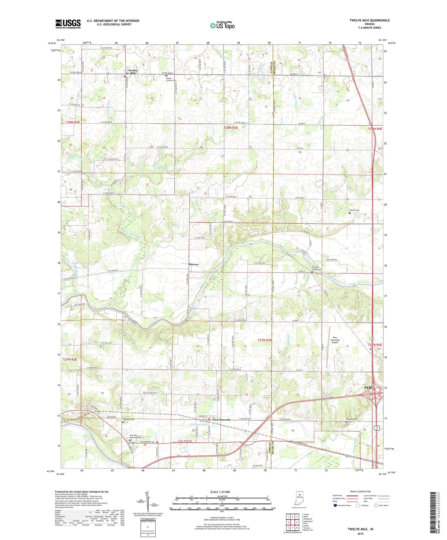
2022 topographic map quadrangle Twelve Mile in the state of Indiana. Scale: 1:24000. Based on the newly updated USGS 7.5' US Topo map series, this map is in the following counties: Cass, Miami. The map contains contour data, water features, and other items you are used to seeing on USGS maps, but also has updated roads and other features. This is the next generation of topographic maps. Printed on high-quality waterproof paper with UV fade-resistant inks.
Quads adjacent to this one:
West: Logansport
Northwest: Fulton
North: Macy
Northeast: Deedsville
East: Peru
Southeast: Bunker Hill
South: Onward
Southwest: Anoka
This map covers the same area as the classic USGS quad with code o40086g2.
Contains the following named places: Bethlehem Church, Bowman Cemetery, Brower Ditch, Corinth Church, East Branch Twelve Mile Creek, Eel River Chapel Cemetery, Ever Rest Memorial Park, Goose Creek, Goose Run, Grable Ditch, Hoover, Indiana State Police Department District 16, Koontz Cemetery, Little Charlie, Losher Ditch, Lowe Ditch, Mount Carmel Cemetery, Mud Branch, New Waverly, New Waverly Fire Department Station 2, Old German Church, Peru Municipal Airport, Skinner Church, Stuber Lake, Township of Adams, Township of Miami, Twelve Mile, Twelve Mile Creek, Twelve Mile Post Office, Twelve Mile Volunteer Fire Department, West Branch Twelve Mile Creek, Williams Cemetery, Williams Ditch, WSAL-FM (Logansport), ZIP Code: 46961