MyTopo
Ackley NE Iowa US Topo Map
Couldn't load pickup availability
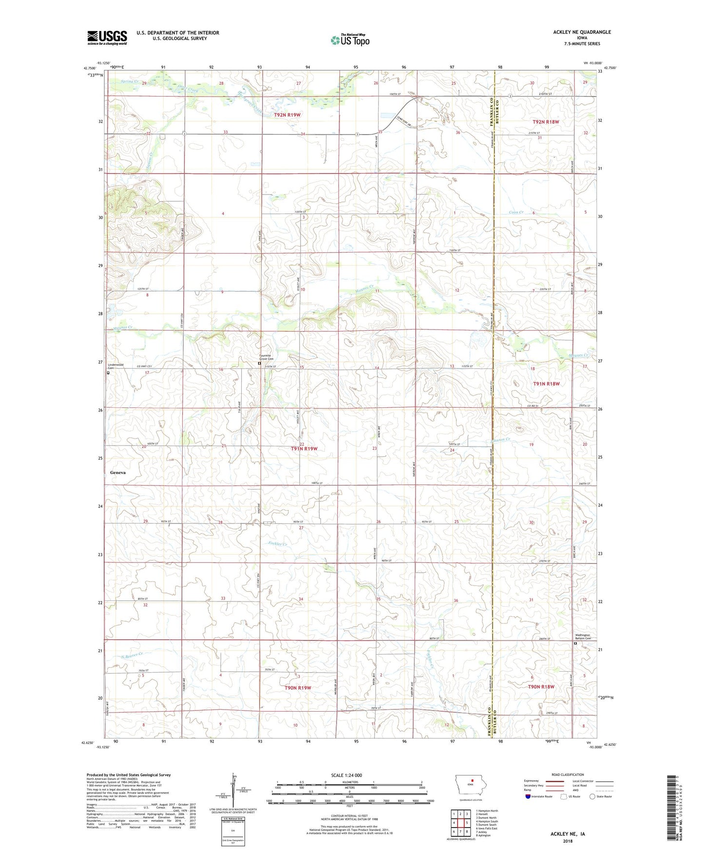
2023 topographic map quadrangle Ackley NE in the state of Iowa. Scale: 1:24000. Based on the newly updated USGS 7.5' US Topo map series, this map is in the following counties: Franklin, Butler. The map contains contour data, water features, and other items you are used to seeing on USGS maps, but also has updated roads and other features. This is the next generation of topographic maps. Printed on high-quality waterproof paper with UV fade-resistant inks.
Quads adjacent to this one:
West: Hampton South
Northwest: Hampton North
North: Hansell
Northeast: Dumont North
East: Dumont South
Southeast: Aplington
South: Ackley
Southwest: Iowa Falls East
This map covers the same area as the classic USGS quad with code o42093f1.
Contains the following named places: Four Mile Grove Cemetery, Handorf Roadside Park, Lindenwood Cemetery, Otter Creek, Spring Creek, Squaw Creek, Township of Geneva, Washington Reformed Cemetery, Washington Reformed Church