MyTopo
Hampton North Iowa US Topo Map
Couldn't load pickup availability
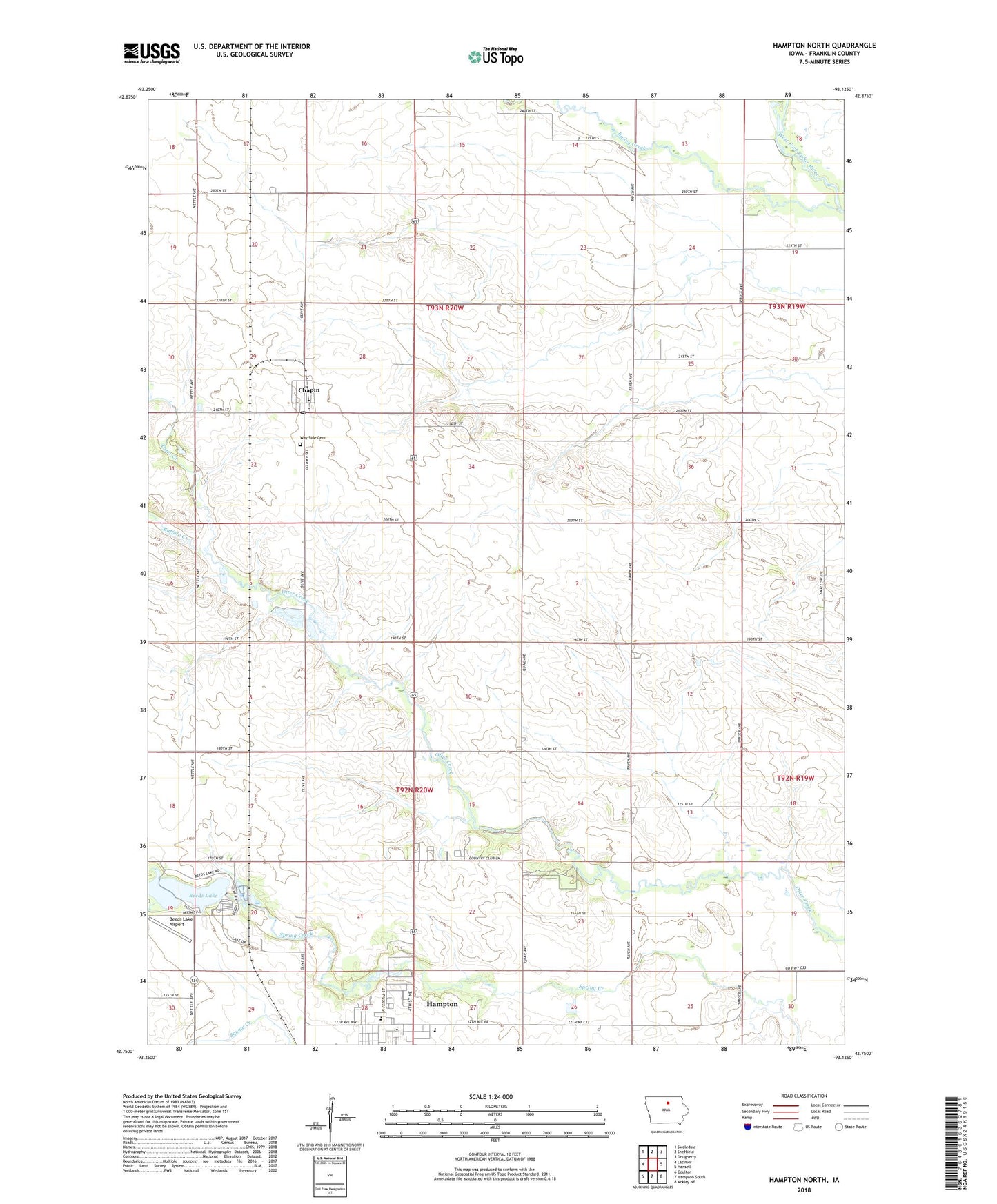
2023 topographic map quadrangle Hampton North in the state of Iowa. Scale: 1:24000. Based on the newly updated USGS 7.5' US Topo map series, this map is in the following counties: Franklin. The map contains contour data, water features, and other items you are used to seeing on USGS maps, but also has updated roads and other features. This is the next generation of topographic maps. Printed on high-quality waterproof paper with UV fade-resistant inks.
Quads adjacent to this one:
West: Latimer
Northwest: Swaledale
North: Sheffield
Northeast: Dougherty
East: Hansell
Southeast: Ackley NE
South: Hampton South
Southwest: Coulter
This map covers the same area as the classic USGS quad with code o42093g2.
Contains the following named places: Bailey Creek, Beeds Lake, Beeds Lake Airport, Beeds Lake State Park, Buffalo Creek, Chapin, Chapin Census Designated Place, Chapin Post Office, Elida Post Office, Hampton - Dumont High School, Hampton - Dumont Middle School, Hampton Country Club, Harriman Park, KWGG-FM (Hampton), North Side Elementary School, Robinson County Park, Saint Patricks Catholic Church, Township of Mott, Township of Ross, Trinity Lutheran Church, Washburn Post Office, Way Side Cemetery, W-K-W County Park