MyTopo
Dumont South Iowa US Topo Map
Couldn't load pickup availability
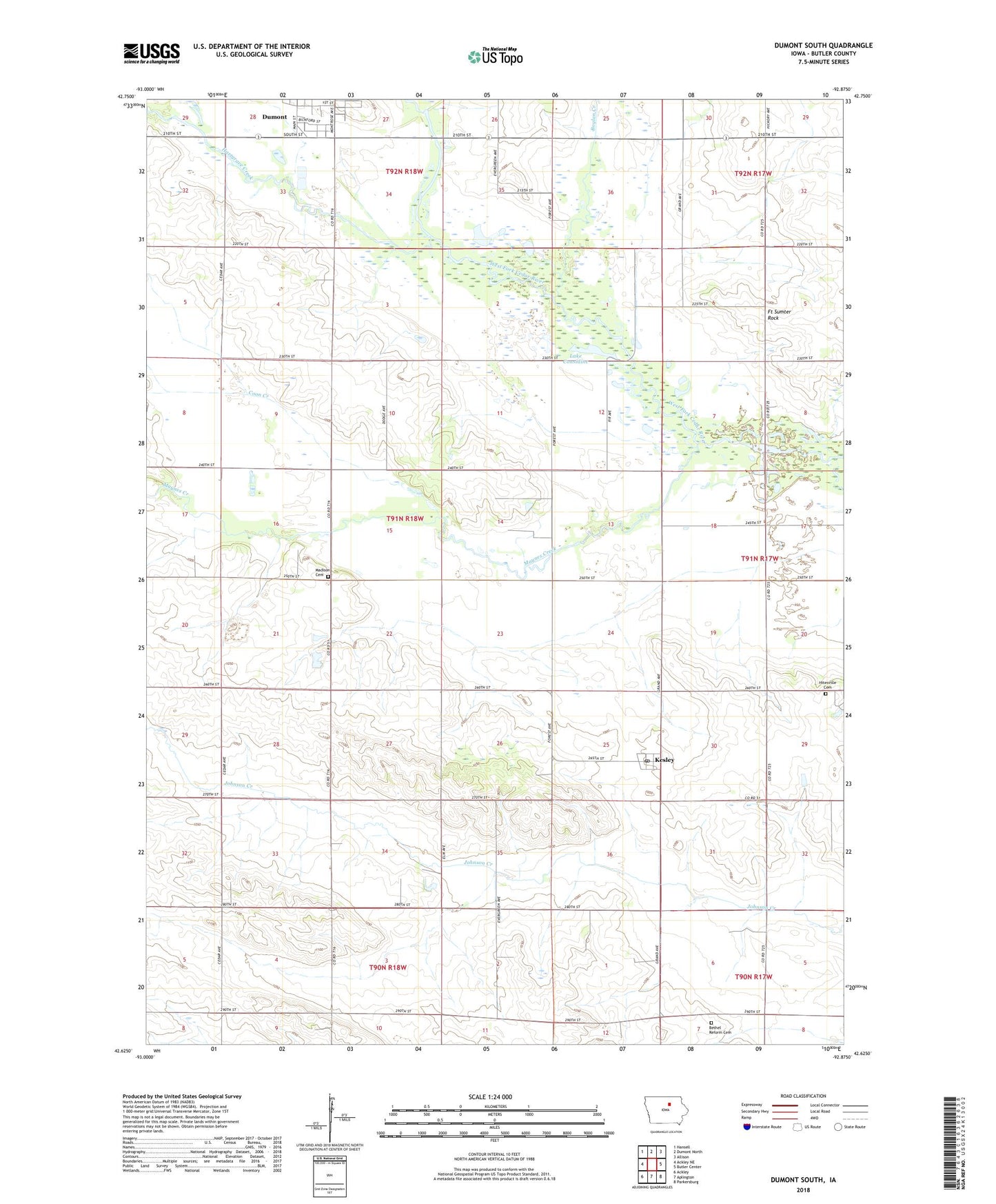
2022 topographic map quadrangle Dumont South in the state of Iowa. Scale: 1:24000. Based on the newly updated USGS 7.5' US Topo map series, this map is in the following counties: Butler. The map contains contour data, water features, and other items you are used to seeing on USGS maps, but also has updated roads and other features. This is the next generation of topographic maps. Printed on high-quality waterproof paper with UV fade-resistant inks.
Quads adjacent to this one:
West: Ackley NE
Northwest: Hansell
North: Dumont North
Northeast: Allison
East: Butler Center
Southeast: Parkersburg
South: Aplington
Southwest: Ackley
This map covers the same area as the classic USGS quad with code o42092f8.
Contains the following named places: Bethel Reform Cemetery, Bethel Reform Church, Boylan Creek, Boylan Creek Wildlife Area, Butler, Clutterville Post Office, Considene Lake Park, Coon Creek, Dumont, Dumont Historical Museum, Dumont Town Hall, Dumont Volunteer Ambulance Service, Farmers Co-op Elevator Company Elevator, Fort Sumter Rock, Hartgrave Creek, Hitesville Cemetery, Hitesville Gospel Hall, Hitesville Post Office, Island Grove Post Office, Kesley, Kesley Post Office, Lake Considine, Madison Township Cemetery, Maynes Creek, South Fork Park, Township of Madison, ZIP Code: 50625