MyTopo
Iowa Falls East Iowa US Topo Map
Couldn't load pickup availability
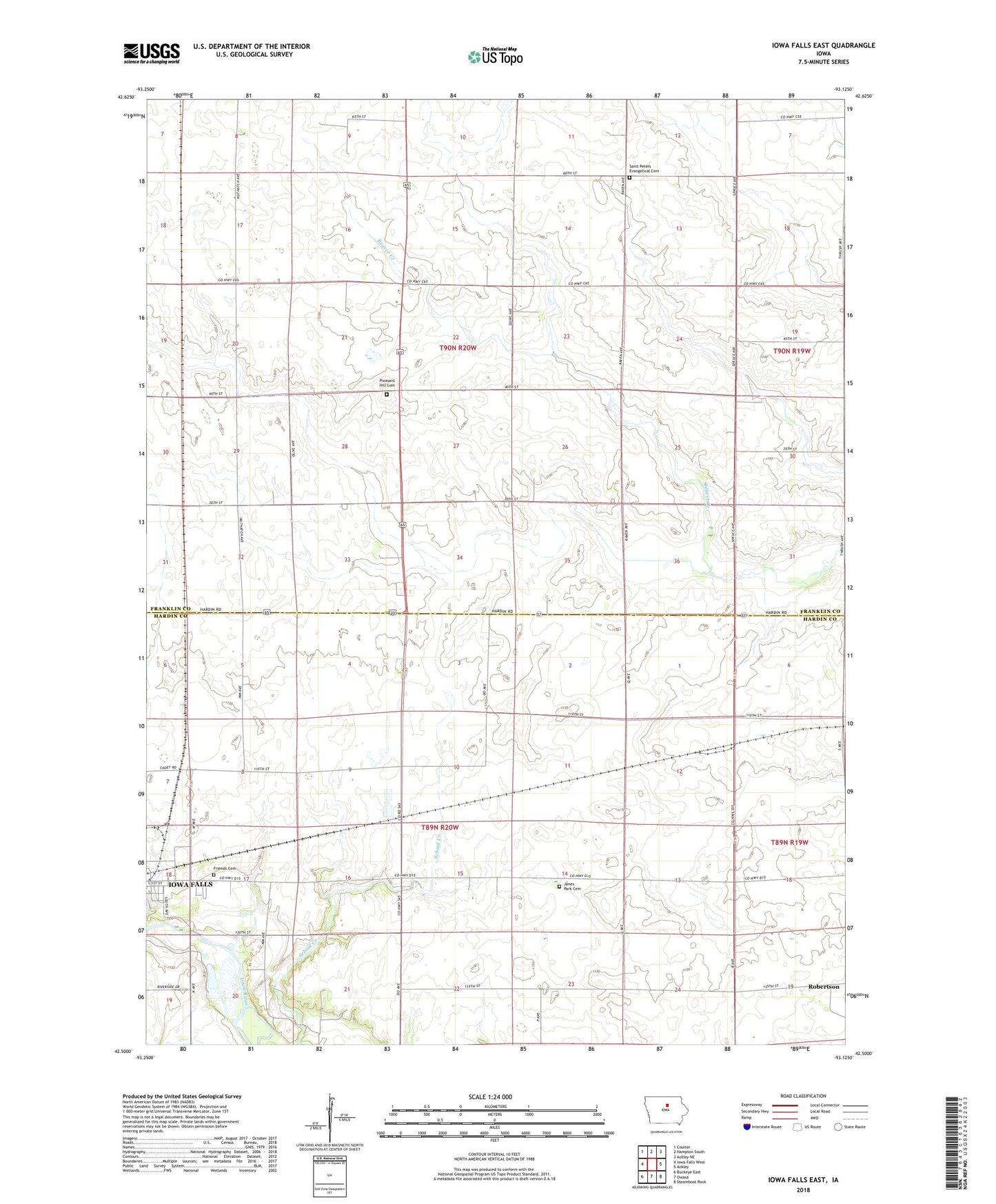
2022 topographic map quadrangle Iowa Falls East in the state of Iowa. Scale: 1:24000. Based on the newly updated USGS 7.5' US Topo map series, this map is in the following counties: Franklin, Hardin. The map contains contour data, water features, and other items you are used to seeing on USGS maps, but also has updated roads and other features. This is the next generation of topographic maps. Printed on high-quality waterproof paper with UV fade-resistant inks.
Quads adjacent to this one:
West: Iowa Falls West
Northwest: Coulter
North: Hampton South
Northeast: Ackley NE
East: Ackley
Southeast: Steamboat Rock
South: Owasa
Southwest: Buckeye East
This map covers the same area as the classic USGS quad with code o42093e2.
Contains the following named places: Ellsworth Municipal Hospital Heliport, Friends Cemetery, Jones Park Cemetery, Julia O'Neil Park, KIFG-AM (Iowa Falls), KIFG-FM (Iowa Falls), Macey, Macy, Macy Post Office, Meadow Hills Golf Course, Pleasant Hill Cemetery, Rathon Post Office, Robertson, Robertson Post Office, Saint Peters Church, Saint Peters Evangelical Cemetery, Township of Grant, Township of Hardin, Welden's Woods