MyTopo
Panther Iowa US Topo Map
Couldn't load pickup availability
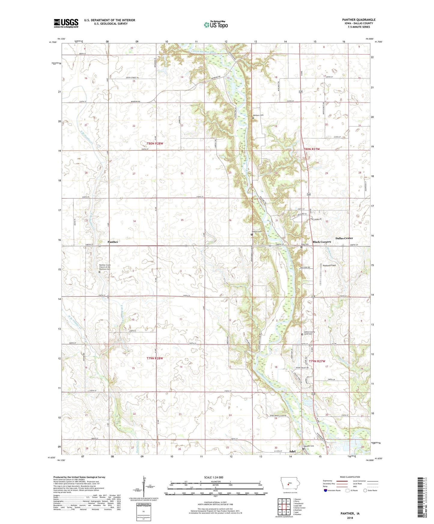
2022 topographic map quadrangle Panther in the state of Iowa. Scale: 1:24000. Based on the newly updated USGS 7.5' US Topo map series, this map is in the following counties: Dallas. The map contains contour data, water features, and other items you are used to seeing on USGS maps, but also has updated roads and other features. This is the next generation of topographic maps. Printed on high-quality waterproof paper with UV fade-resistant inks.
Quads adjacent to this one:
West: Adel NW
Northwest: Dawson
North: Perry
Northeast: Woodward
East: Dallas Center
Southeast: Waukee
South: Adel
Southwest: Redfield
This map covers the same area as the classic USGS quad with code o41094f1.
Contains the following named places: Black Corners, Central Dallas School, County Home Cemetery, Crellin Wildlife Refuge, Dallas County, Dallas County Care Facility, East Branch Panther Creek, Highway Forty-Four Access, Husband Field, Jenkins Cemetery, King Cemetery, Minburn Cemetery, Oakdale Cemetery, Panther, Panther Creek Church, Panther Creek Church of the Brethren, Panther Creek Church of the Brethren Cemetery, Panther Post Office, Pierce Point, River Valley Golf Course, Snyder Access, Township of Colfax, Township of Washington, Washington Chapel, Washington School, West Branch Panther Creek, ZIP Code: 50167