MyTopo
Redfield Iowa US Topo Map
Couldn't load pickup availability
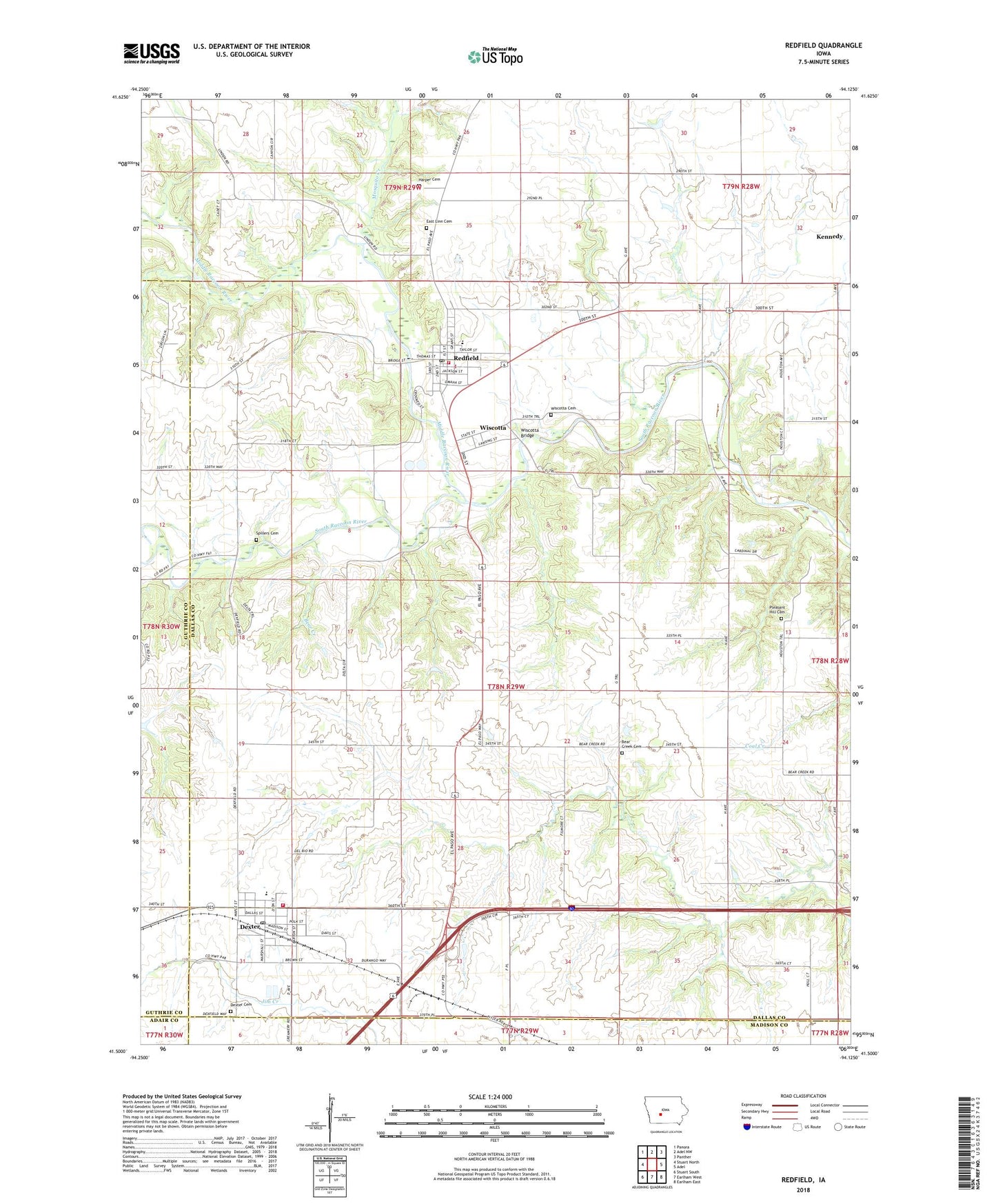
2022 topographic map quadrangle Redfield in the state of Iowa. Scale: 1:24000. Based on the newly updated USGS 7.5' US Topo map series, this map is in the following counties: Dallas, Guthrie, Madison, Adair. The map contains contour data, water features, and other items you are used to seeing on USGS maps, but also has updated roads and other features. This is the next generation of topographic maps. Printed on high-quality waterproof paper with UV fade-resistant inks.
Quads adjacent to this one:
West: Stuart North
Northwest: Panora
North: Adel NW
Northeast: Panther
East: Adel
Southeast: Earlham East
South: Earlham West
Southwest: Stuart South
This map covers the same area as the classic USGS quad with code o41094e2.
Contains the following named places: Bear Creek Cemetery, Bear Creek Church, Bear Creek School, Beaver Lake, Beaver Lake Campground, Calvary Assembly of God Church, City of Dexter, City of Redfield, Dallas Lake State Wildlife Area, Dexter, Dexter Cemetery, Dexter City Hall, Dexter Library, Dexter Post Office, Dexter United Methodist Church, Dexter Volunteer Fire Department, East Linn Cemetery, First Presbyterian Church, Friends Church, Grainco Incorporated Elevator, Hanging Rock Park, Harper Cemetery, Heartland Co-op Elevator, Kingdom Hall of Jehovah's Witnesses, Kuehn Conservation Area, Middle Raccoon River, Mosquito Creek, Pleasant Hill Cemetery, Raccoon River Trail, Redfield, Redfield Christian Church, Redfield City Hall, Redfield Emergency Medical Services, Redfield Medical Clinic, Redfield Post Office, Redfield Public Library, Redfield Volunteer Fire Department, South Raccoon River Access, Spillers Cemetery, Township of Union, West Central Valley Dexter Elementary School, West Central Valley Middle School, Wiscotta, Wiscotta Bridge, Wiscotta Cemetery, Zion Lutheran Church, ZIP Code: 50233