MyTopo
Akron Iowa US Topo Map
Couldn't load pickup availability
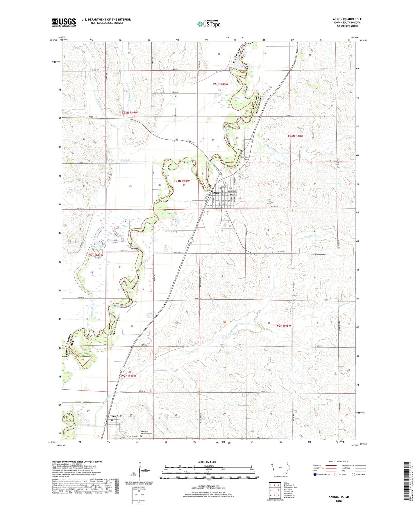
2022 topographic map quadrangle Akron in the states of Iowa, South Dakota. Scale: 1:24000. Based on the newly updated USGS 7.5' US Topo map series, this map is in the following counties: Plymouth, Union. The map contains contour data, water features, and other items you are used to seeing on USGS maps, but also has updated roads and other features. This is the next generation of topographic maps. Printed on high-quality waterproof paper with UV fade-resistant inks.
Quads adjacent to this one:
West: Richland
Northwest: Nora
Northeast: Hawarden South
East: Ireton SW
Southeast: Millnerville
South: Elk Point NE
Southwest: Elk Point
Contains the following named places: Akron, Akron - Westfield Elementary School, Akron - Westfield High School and Middle School, Akron - Westfield Middle School, Akron Chiropractic Center, Akron City Convalescent Care, Akron Country Club, Akron Dental Clinic, Akron Emergency Medical Services Department, Akron Family Practice Clinic, Akron Municipal Airport, Akron Post Office, Akron Public Library, Akron Volunteer Fire Department, Beaver Creek, Beeck Family Chiropractic Clinic, Big Sioux County Park, City of Akron, City of Westfield, East Union Creek, Farmers Co-operative Elevator, First Baptist Church, First Church of Christ, Immanuel Lutheran Church, Lake Nixon, Riverside Cemetery, Saint Patricks Catholic Church, Saint Patricks Cemetery, Sayles Creek, Silver Maple County Park, Siouxland Paramedics Westfield Station, Township of Portland, Township of Sioux Valley, Township of Westfield, Trinity Lutheran Church, Union Creek, Wesley United Methodist Church, West Union Creek, Westfield, Westfield Congregational Church, Westfield Creek, Westfield Post Office, Westfield Township Cemetery, ZIP Code: 51001